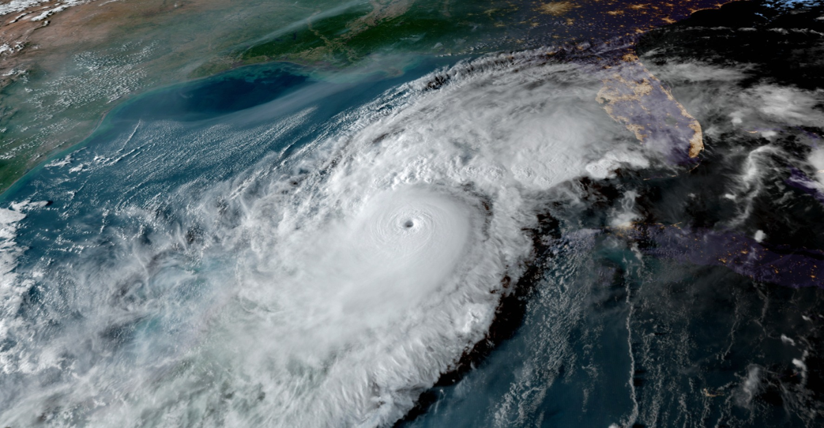
In 2025, there will be unusual calm in the tropics, which will usually be a breeding ground for intense storms. Tropical cyclone activity is noticeably muted despite record-warm ocean temperatures in subtropical areas; the first hurricane-strength system in the Northern Hemisphere arrived later than it has in more than three decades. Experts caution that this lull may not last because the current oceanic and atmospheric configuration is inhibiting the formation of storms.
This paradox casts doubt on the oversimplified theory that storm frequency is directly correlated with global warming. It compels climate scientists and meteorologists to reconsider the intricate relationships among storm genesis, atmospheric dynamics, and ocean heat content. Before the inevitable return of storm activity, which could be more intense due to accumulated oceanic heat, the current calm is a strategic time to increase readiness.
Silent Times and Unexpected Increases
Tropical cyclone activity is cyclical, with alternating quiet and active regimes, as history has shown. After a protracted lull from the 1970s to the early 1990s, storm frequency increased in the following decades. These dormant times are not harmless; they frequently come to an abrupt end with harsh, destructive seasons. There are worries that accumulated oceanic heat and atmospheric instability may soon cause a sharp increase in storms as the current calm echoes historical patterns.
Although there are fewer storms during the quiet periods, the ocean still retains heat energy. This stored energy can cause storms to intensify quickly when conditions change. The risk of underestimating the threat during lulls is demonstrated by the 1995 Atlantic hurricane season, which was one of the most active on record after a period of calm. For emergency management, which must foresee not only the current season but also the dormant energy that is waiting to be released in subsequent years, this historical perspective is essential.
Oceanic Abnormalities—Warmth That Suppresses Paradoxically
Fewer tropical storms in 2025 are associated with record-warm subtropical waters. Extreme warmth in the subtropics can upset the delicate balance necessary for cyclone formation, which leads to this counterintuitive effect. Rather than intensifying storms, the heat modifies atmospheric circulation and stability, which hinders the formation of cyclones from disturbances.
Storm formation is hampered by these circumstances. Convection may also be further suppressed by the warm waters’ ability to promote the formation of dry air masses that penetrate the tropics. This intricate feedback loop shows that storm activity cannot be predicted solely by ocean temperature. In order to enhance seasonal forecasts and gain a better understanding of how climate change may impact these dynamics in unpredictable ways, scientists are now concentrating on these complex interactions.
Storm-Resisting Atmospheric Stability

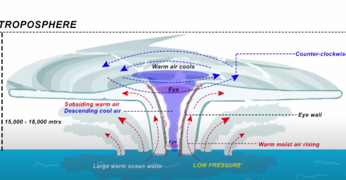
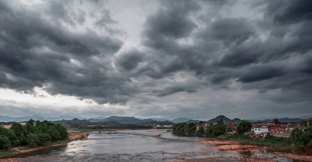
The upper atmosphere’s unusually warm conditions have produced a stable atmosphere that inhibits the formation of thunderstorms, which are a crucial prelude to tropical cyclones. The high temperatures this year are significantly higher than usual, which prevents the vertical motion required for storm formation. As a lid, atmospheric stability keeps the moist, rising air that fuels cyclones from forming.
A phenomenon called a temperature inversion, in which warmer air covers cooler air close to the surface, essentially halting convection exacerbates this atmospheric stability. Storms are unable to form the ordered structure required to become cyclones in the absence of upward air movement. Moreover, this stability lessens precipitation and cloud formation, which can have a domino effect on local weather patterns, including drought in some tropical regions.
The Function of Dry Air and Wind Shear

The development of cyclones in 2025 has been hindered by high vertical wind shear and a surplus of dry, dusty air, especially from the Sahara. While dry air suffocates the moisture supply, wind shear upsets the storms’ vertical structure. These elements, which are frequently disregarded in public discussions, are just as crucial in determining the frequency of storms as ocean temperature.
Strong wind shear, or variations in wind direction or speed with altitude, rips storm structures apart before they have a chance to develop. Tropical cyclone activity is effectively suppressed by this combination of natural factors. Understanding the impact of these atmospheric variables emphasizes the difficulty of forecasting and helps explain why the tropics can be peaceful even with warm ocean temperatures.
Climate Change: A Two-Sided Blade
According to recent studies, climate change may be causing tropical cyclones to occur 13% less frequently while simultaneously intensifying them when they do. Cyclone formation can be significantly impacted by slight changes in atmospheric and ocean conditions, which are exacerbated by global warming.
This contradiction occurs because storms are given more energy by warming oceans, but their formation can be inhibited by shifting atmospheric patterns like increased wind shear and changed humidity profiles. As a result, there are fewer storms in the landscape, but the ones that do occur are stronger, last longer, and produce more rainfall. The insurance sector, emergency management, and coastal communities are all significantly impacted by this trend.
The Factor of El Niño/La Niña
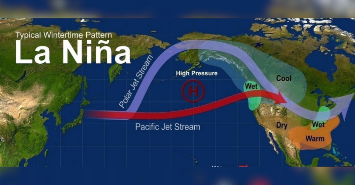
This season has seen a record-breaking lack of tropical storms due in part to the delayed onset of La Niña conditions. Although La Niña usually promotes cyclone development and lessens wind shear, its delayed arrival has prolonged the unfavorable conditions.
Hurricane activity has been shown to be impacted by El Niño and La Niña, two phases of the El Niño-Southern Oscillation (ENSO). La Niña tends to decrease wind shear, which encourages storms, whereas El Niño tends to increase it, suppressing storms. The atmosphere remained hostile for a more extended period of time than usual in 2025 due to the delayed La Niña. This delay may be impacted by climate change and is associated with wider climate variability.
Unusual Case Studies: Storms in the Late and Off-Season
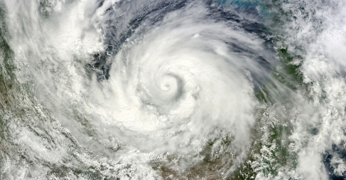
Anomalies have already occurred in 2025, including the formation of off-season lows in unusual areas and the most recent hurricane to hit the Northern Hemisphere in more than 30 years. These anomalies imply that although there are fewer storms overall, the system is not dormant; instead, it is delayed or displaced.
Traditional definitions of hurricane seasons are called into question by off-season storms and late starts, which also make preparations more difficult. Shifting climatic patterns, such as variations in atmospheric circulation and sea surface temperatures, may be connected to these anomalies. They remind us that the tropics are dynamic and that safety is not always guaranteed by a quiet season. A year-round, adaptable, and scientifically informed approach to preparedness is required.
Effects of the Second and Third Orders—Unknown Risks

Complacency brought on by a slow tropical season can result in a lack of readiness when activity picks back up. Public awareness may decline, emergency services may loosen, and insurance markets may reduce premiums. In the meantime, drought may impact water supplies and agriculture in ecosystems that rely on consistent rainfall from tropical systems.
In terms of ecology, in tropical areas, the lack of storms can interfere with freshwater replenishment and nutrient cycles. The interdependence of climate systems and human society is emphasized by these second- and third-order effects, which also underscore the importance of taking proactive rather than passive measures during the quiet before the storm.
The Significance of the Quiet
The tropical calm that is currently in place is a warning rather than an indication of safety. The quiet is only temporary, and the likelihood of a hyperactive season is still high, according to all indicators, including oceanic heat and atmospheric anomalies. Emerging anomalies, climatic trends, and historical precedent all suggest that a sudden spike in activity is likely.
The quiet time presents a calculated chance to strengthen infrastructure, enhance forecasting, and inform the public. When the storm cycle reactivates, disregarding these warnings could have disastrous results. The current lull is a complicated, multidimensional phenomenon that challenges presumptions and necessitates an advanced, proactive response in order to protect livelihoods and lives.
Explore more of our trending stories and hit Follow to keep them coming to your feed!

Don’t miss out on more stories like this! Hit the Follow button at the top of this article to stay updated with the latest news. Share your thoughts in the comments—we’d love to hear from you!


