On June 20, 2025, a 5.1 magnitude earthquake struck northern Iran near the city of Semnan, at approximately 27 to 37 kilometers southwest of the city center. The tremor occurred at a shallow depth of 10 kilometers, intensifying the shaking felt across the region. This seismic event unfolded amid escalating regional tensions, notably between Iran and Israel, raising concerns due to its proximity to sensitive military and space facilities, including the Semnan Space Center and Missile Complex.
Despite the quake’s strength, Iranian authorities reported no casualties or major structural damage, though the event stirred public unease and speculation. The earthquake serves as a reminder of Iran’s position along active fault lines and the complex geopolitical landscape surrounding the region.
Precise Epicenter and Seismic Characteristics
The earthquake’s epicenter was pinpointed between 27 and 37 kilometers southwest of Semnan city in northern Iran. It struck at a depth of 10 kilometers, a relatively shallow depth that contributed to the intensity of the shaking experienced locally. The United States Geological Survey (USGS) classified the shaking as “light” on the Modified Mercalli Intensity scale, indicating noticeable shaking but limited damage potential.
The magnitude, recorded at 5.1, aligns with moderate seismic activity, capable of rattling structures and prompting evacuations but not typically causing severe destruction. The quake was felt across northern Iran, including parts of Tehran, underscoring its regional reach.
Positioned on a Major Tectonic Convergence Zone
Iran lies on the Alpine-Himalayan seismic belt, a highly active tectonic region where the Arabian and Eurasian plates converge. This geological setting makes Iran one of the most earthquake-prone countries globally, experiencing thousands of tremors annually. Historically, the region has suffered devastating earthquakes that have caused significant loss of life and damage to infrastructure.
The Semnan area, near the quake’s epicenter, is no exception, situated atop fault lines that regularly produce seismic activity. Understanding this tectonic context is crucial for interpreting the natural origins of the June 20 quake and assessing future seismic risks in the region.
Immediate Effects and Damage Reports

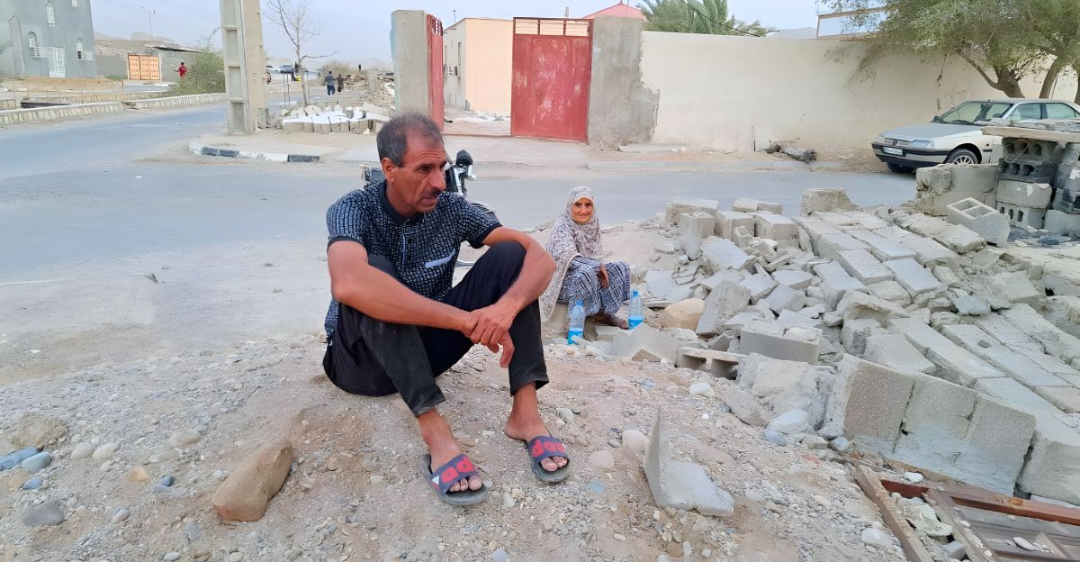
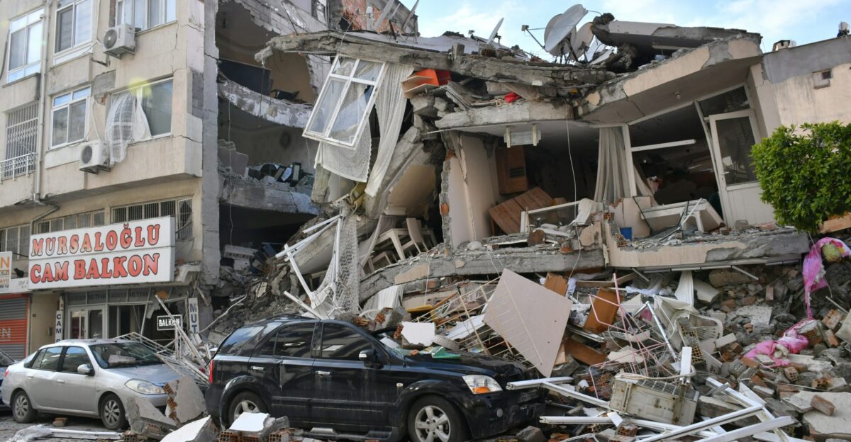
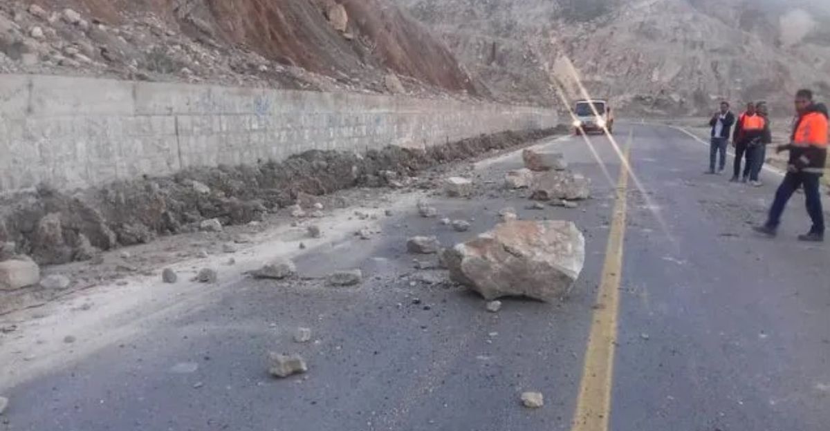
Following the earthquake, residents in Semnan and surrounding areas reported homes rattling and many evacuating buildings as a precaution. Despite the tremors’ intensity, Iranian authorities confirmed there were no casualties and only minimal structural damage. Local crisis management teams were promptly deployed to assess the situation, focusing on rural and older constructions that are more vulnerable to seismic impacts.
The lack of significant damage is attributed to the quake’s moderate magnitude and the region’s preparedness, though ongoing assessments aim to ensure no hidden or delayed structural issues.
Near Semnan Space Center and Missile Complex
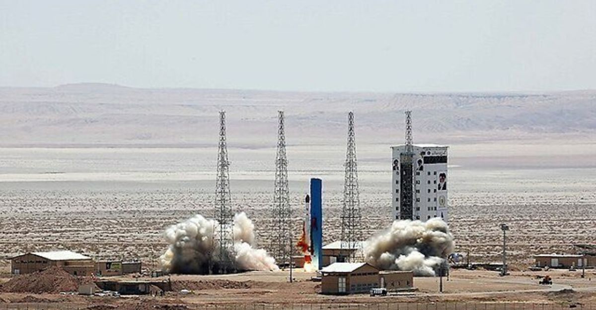
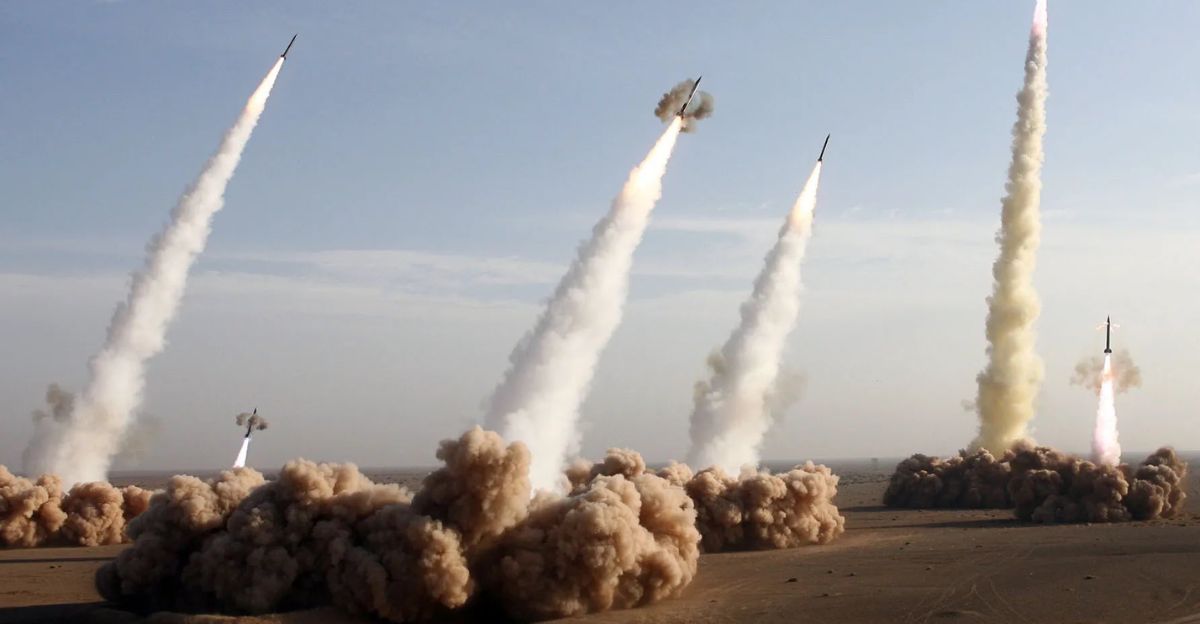
The earthquake’s epicenter was alarmingly close to key military and space installations, notably the Semnan Space Center and the Semnan Missile Complex. These facilities are critical to Iran’s ballistic missile testing and space launch capabilities, with the missile complex reportedly developed with substantial foreign assistance.
The proximity of the quake to these sensitive sites raised concerns about potential impacts on national security infrastructure and operational readiness. While no damage has been reported at these complexes, the event underscores the vulnerability of strategic assets in seismically active zones.
Nuclear Testing Rumors and Expert Analysis
The timing and location of the earthquake sparked public and media speculation that it might be linked to an underground nuclear test by Iran, especially amid heightened tensions with Israel. However, seismologists and experts quickly dismissed these claims, emphasizing that nuclear tests typically produce shallower seismic events of lower magnitude, generally below 3.0. A magnitude 5.1 quake would require an explosive force far exceeding that of known nuclear tests.
Historical comparisons, such as North Korea’s 2016 nuclear test which registered a similar magnitude, show that natural earthquakes of this size are common in tectonically active regions like Iran. Experts conclude the quake was of natural seismic origin.
Earthquake Amid Escalating Iran-Israel Conflict
The earthquake occurred during a period of escalating conflict between Iran and Israel, with military exchanges and cyber operations intensifying. The region’s instability adds layers of complexity to the earthquake’s aftermath, as any disruption near military sites could have broader security implications.
The tremor’s proximity to missile and space facilities heightened anxieties about potential vulnerabilities amid ongoing hostilities. This intersection of natural disaster and geopolitical tension highlights the fragile balance in the Middle East, where environmental and political crises can compound each other.
Monitoring and Crisis Management Efforts

The United States Geological Survey (USGS) and Iranian seismic agencies played key roles in monitoring the earthquake and disseminating information. Iranian local authorities, including the Semnan crisis management agency, swiftly deployed rescue and assessment teams to evaluate the quake’s impact.
These efforts focused on ensuring public safety, assessing infrastructure integrity, and preparing for possible aftershocks. The coordinated response reflects improved disaster preparedness in a region frequently challenged by seismic hazards, though ongoing vigilance remains essential given the proximity to critical military installations.
Lessons from Iran’s Earthquake Past
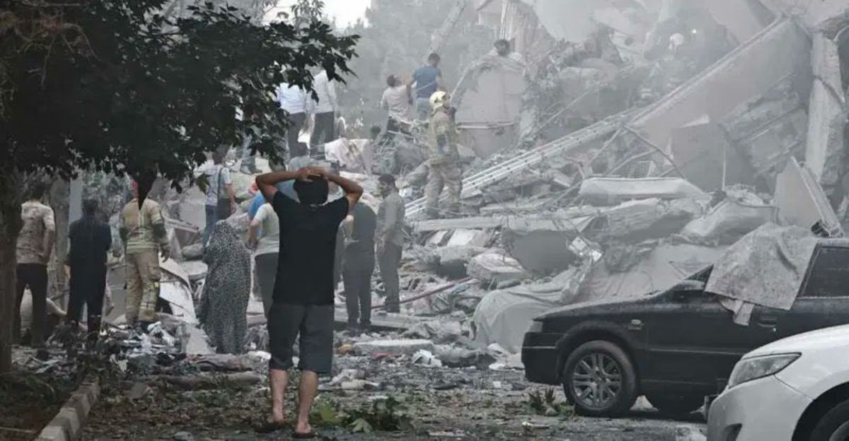
Iran’s history is marked by devastating earthquakes, such as the 2003 Bam earthquake which caused over 26,000 deaths. These tragic events have shaped national policies on building codes, emergency response, and public awareness. The June 20 quake, while moderate, serves as a reminder of the persistent seismic threat.
Past experiences have underscored the importance of resilient infrastructure and rapid crisis management. Comparing this event with previous extreme cases highlights progress in preparedness but also the ongoing need for investment in seismic safety, especially near strategic sites.
Monitoring, Transparency, and Regional Stability
The 5.1 magnitude earthquake near Semnan on June 20, 2025, underscores Iran’s geological vulnerability and the complex geopolitical context of the region. While no casualties or major damage occurred, the quake’s proximity to sensitive military and space facilities raises important questions about risk management and national security.
Continued scientific monitoring and transparent reporting are crucial to understanding seismic activity in this volatile area. Looking ahead, fostering regional stability and enhancing disaster preparedness will be vital to mitigating the compounded risks posed by natural and political crises in northern Iran.


