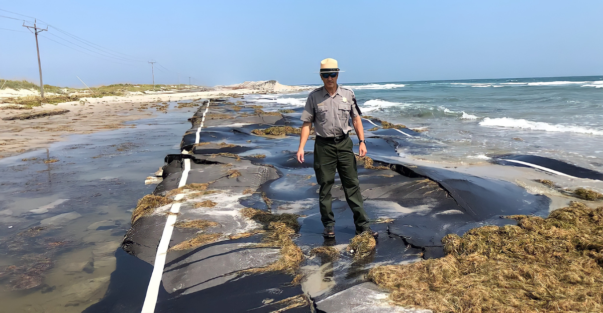
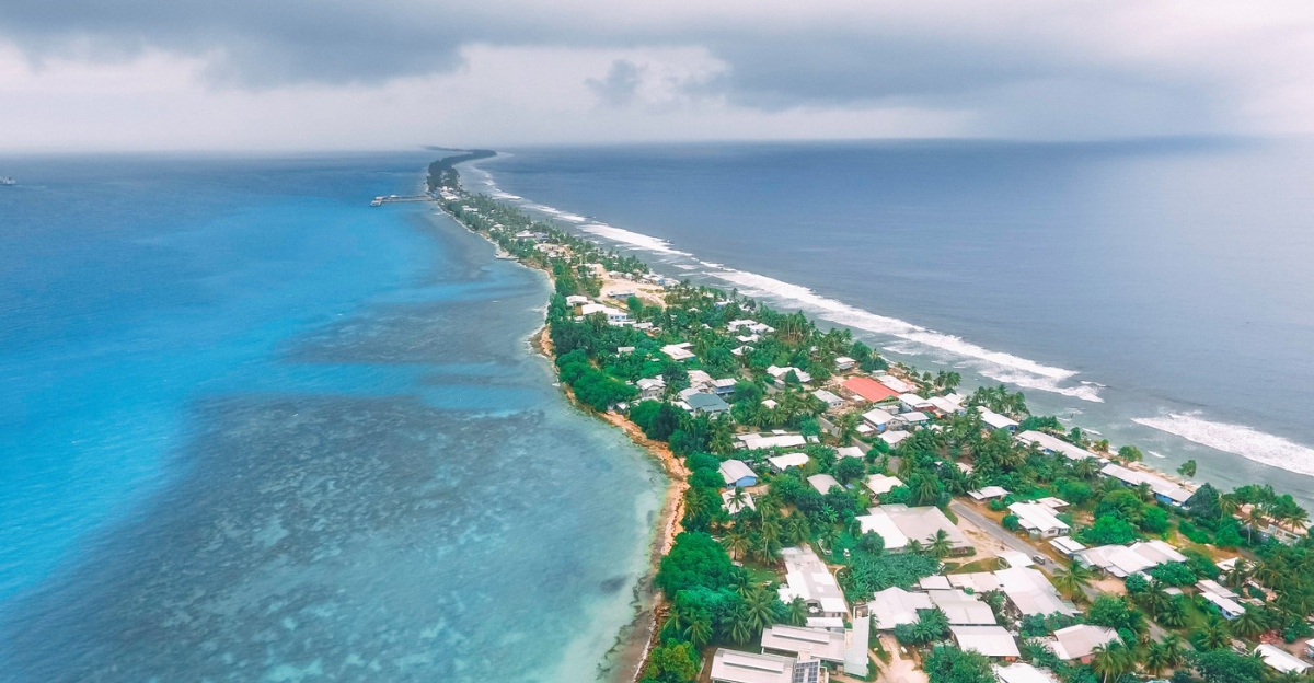
Once a lush, grassy island on the U.S. East Coast is now sinking beneath rising waters, symbolizing a growing crisis for coastal regions worldwide. This island’s disappearance highlights the dual threat of sea level rise and land subsidence where the land is sinking, compounding the risk of flooding and land loss.
Historically vibrant and ecologically rich, the island’s fate is a stark warning about the accelerating impacts of climate change and human activity on coastal landscapes. Understanding this interplay is crucial for protecting vulnerable communities and infrastructure along the coast.
The Science Behind Island Sinking: Sea Level Rise and Land Subsidence
Global sea levels are rising primarily due to melting ice sheets and the thermal expansion of seawater as the planet warms. Land subsidence, the sinking of land caused by natural sediment compaction and human activities like groundwater extraction, exacerbates this problem.
When combined, these factors accelerate coastal land loss by increasing relative sea level rise and the height of the sea relative to the land, which leads to more frequent and severe flooding in coastal areas.
Case Study: The East Coast’s Rapid Subsidence

Research from Virginia Tech and the US Geological Survey reveals that East Coast cities such as Virginia Beach, Norfolk, and New York City are sinking at 5 to 7 millimeters per year, outpacing the average sea level rise of about 3.5 millimeters annually.
This rapid subsidence intensifies the threat of flooding and land loss, making these urban centers particularly vulnerable to climate impacts and demanding urgent adaptation measures.
Consequences for Infrastructure and Communities
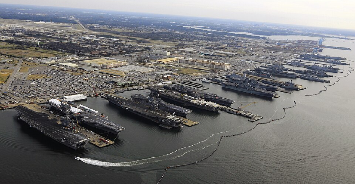
The sinking of the East Coast island and surrounding areas threatens critical infrastructure, including airports, highways, and naval bases like Naval Station Norfolk.
Nearly a million residents face increased flood risks, with billions of dollars worth of property potentially underwater by 2050. The economic and social consequences profoundly affect public safety, housing stability, and regional economies.
Unexpected Intersections: Urban Development and Subsidence
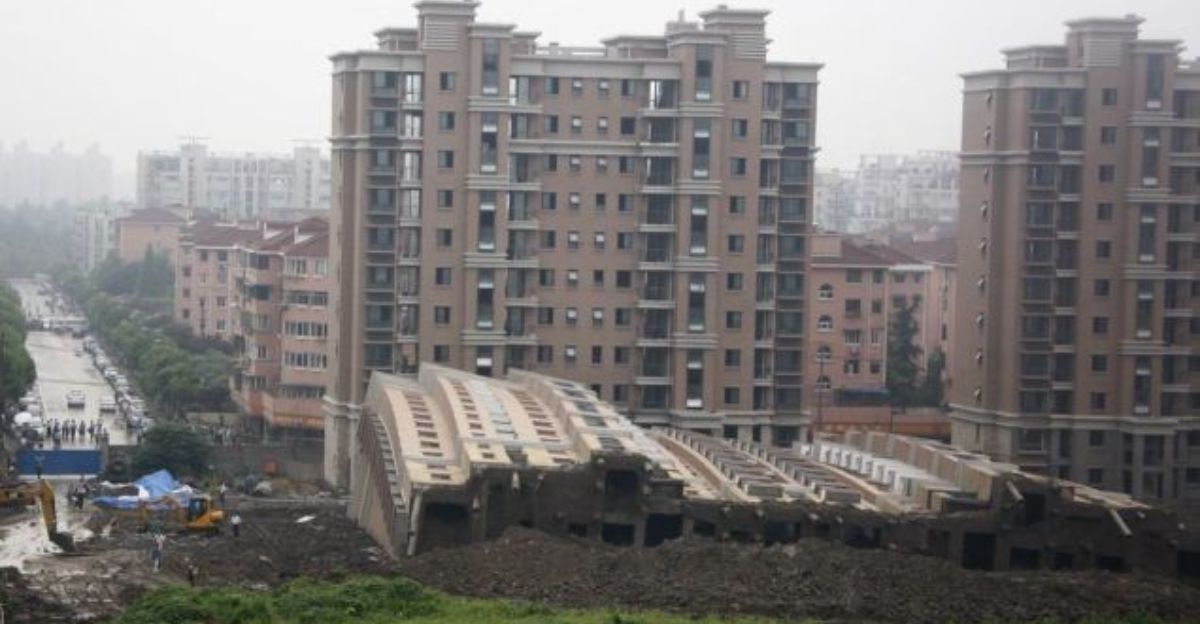
Urban development on soft sediments and artificial fill, seen in places like O’ahu and Hawai’i, worsens subsidence. Heavy infrastructure and excessive groundwater extraction compact soil layers, accelerating land sinking.
These human-induced factors complicate coastal resilience efforts, highlighting the need for urban planning that accounts for subsidence alongside sea level rise to protect communities and infrastructure.
Contrarian Viewpoint: Is Subsidence Manageable?

Some experts view subsidence as a slow-moving, serious hazard that can be mitigated with timely interventions. Low-cost adaptive measures such as controlled groundwater use, improved land management, and engineered solutions can slow land sinking.
Early action is essential to avoid catastrophic outcomes, emphasizing the importance of integrating subsidence management into coastal planning.
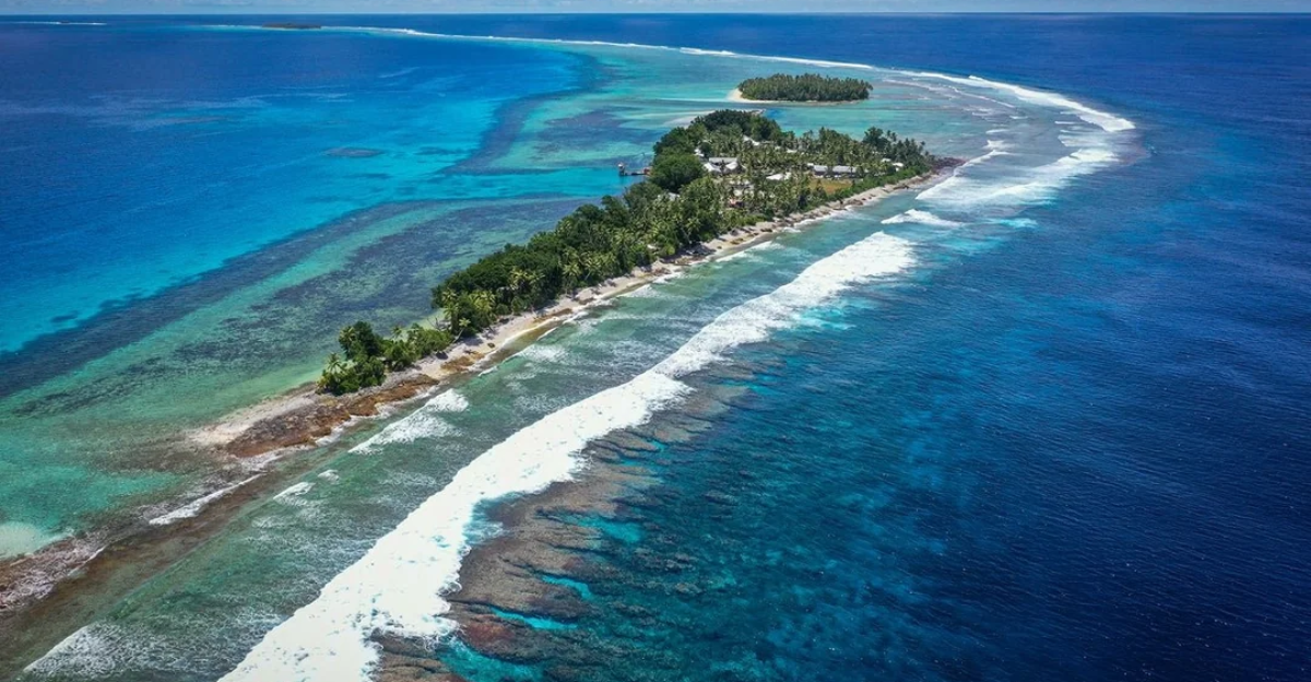
Extreme Examples: Islands and Cities Worldwide Facing Similar Fates
The fate of the East Coast island mirrors challenges faced by Pacific islands like Tuvalu and Kiribati, which are at risk of complete inundation. Other U.S. cities such as Houston and Miami also confront combined threats of sinking land and rising seas.
Globally, this dual challenge demands coordinated responses to protect vulnerable coastal populations and ecosystems.
Historical Context: How Past Climate and Geological Events Shape Today’s Risks

The legacy of the last Ice Age still influences current land elevation patterns through processes like glacial rebound and fore-bulge collapse. Historical shoreline changes and human modifications have increased vulnerability to flooding.
These geological and climatic histories provide valuable lessons for modern coastal management, underscoring the complexity of addressing current sea level and subsidence challenges.
Data-Driven Insights: New Maps and Satellite Research

High-resolution satellite radar mapping now identifies subsidence hotspots with unprecedented accuracy. Studies in New Zealand and U.S. urban centers reveal rapid sinking zones, enabling better flood risk assessment and targeted adaptation strategies.
Reliable data is critical for informed decision-making to protect coastal communities from escalating risks.
Urgency and Path Forward
The disappearance of the East Coast island exemplifies a broader crisis of rising seas and sinking lands. Addressing this requires integrated approaches to tackling rising sea and subsidence through science-based urban planning, infrastructure adaptation, and community preparedness.
There remains a narrow window of opportunity to manage these threats effectively and safeguard coastal futures.
Discover more DIY hacks and style inspo- Follow us to keep the glow-up coming to your feed!

Love content like this? Tap Follow at the top of the page to stay in the loop with the latest beauty trends, DIY tips, and style inspo. Don’t forget to share your thoughts in the comments — we love hearing from you!


