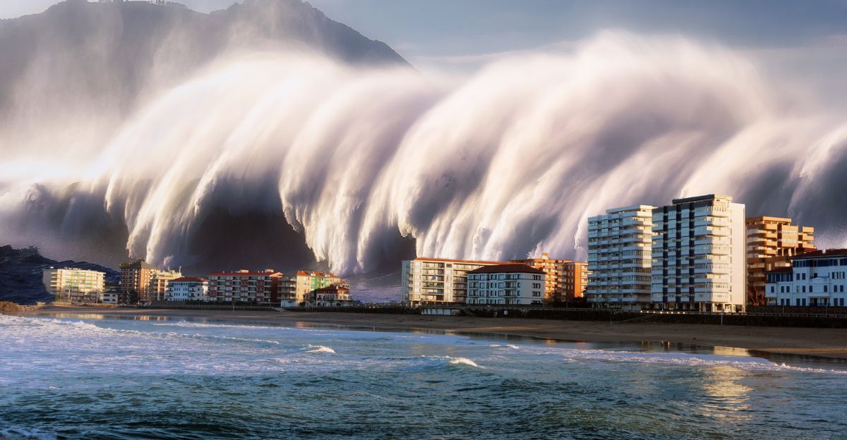
Imagine waking up to the roar of a wall of water taller than a skyscraper, crashing toward the Pacific Northwest coast with unstoppable force. For millions living from Northern California to British Columbia, this isn’t the plot of a disaster movie; it might just be reality. The Cascadia Subduction Zone has been quiet for years and is due for a rupture soon enough. When this happens, it will send waves more than 100 feet high barreling inland.
Not to mention the miles and miles of land that will sink with several feet in just minutes. With a 15% chance of such a massive earthquake striking within the next 50 years, the question isn’t just if you’re at risk and whether you’ll have any warning when the sleeping giant awakens.
Understanding the Cascadia Subduction Zone
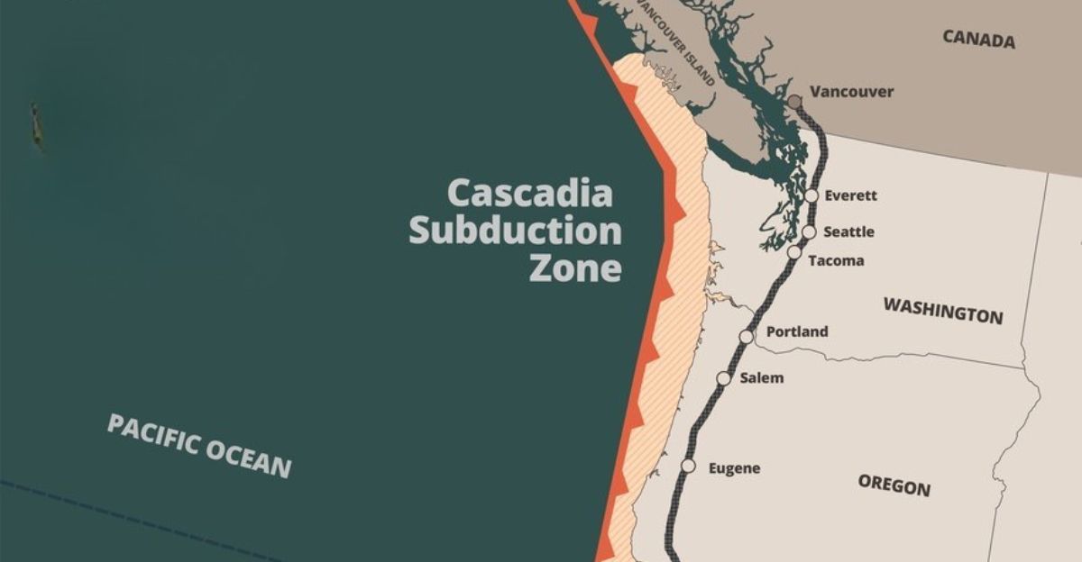
The Cascadia Subduction Zone (CSZ) is where the Juan de Fuca oceanic plate slowly slides beneath the North American continental plate. The plate is a 700-mile tectonic boundary stretching from Northern California to British Columbia. It had lain dormant since its last catastrophic rupture in 1700 when it unleashed a magnitude 9.0+ megathrust earthquake and a tsunami that reached Japan.
Cascadia has been locked for years, storing energy that could be released at any moment. Geological records show recurring megaquakes every 400-600 years, and the CSZ now enters its highest risk window in three centuries.
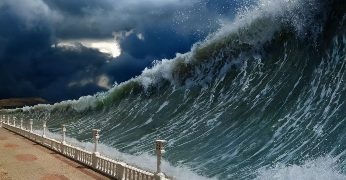
What Is a Megatsunami?
This isn’t just your average tsunami, think tsunami, but 10 times bigger than usual, causing havoc everywhere you look. Underwater earthquakes usually trigger ordinary tsunamis and typically reach maximum heights of around 100 feet, but they are generally much smaller. Megatsunamis can tower hundreds of feet high, with some historical examples exceeding over 1,600 feet.
While ordinary tsunamis can travel vast distances across oceans, megatsunamis tend to lose energy more quickly, but their initial impact zone can be catastrophic.
Double The Threat
Nothing is worse than a double threat, mainly if they are meant to cause havoc wherever they go. When the Cascadia Subduction Zone finally ruptures, the ground can shake violently for up to five minutes, toppling buildings and crippling infrastructure. But the shaking is only the beginning. As the plates slip, vast stretches of coastline could suddenly drop by as much as 6.5 feet, causing a rapid and permanent rise in local sea level.
“The tsunami is going to come in, and it’s going to be devastating. But with tsunamis, we also know that some places are going to be very hard hit, while other places are probably not going to feel as severe effects because of the way the coast is configured. But those areas can still be in the zone of subsidence.” said researcher Tina Dura, an assistant professor of geosciences in the College of Science.
Who Is Most at Risk?
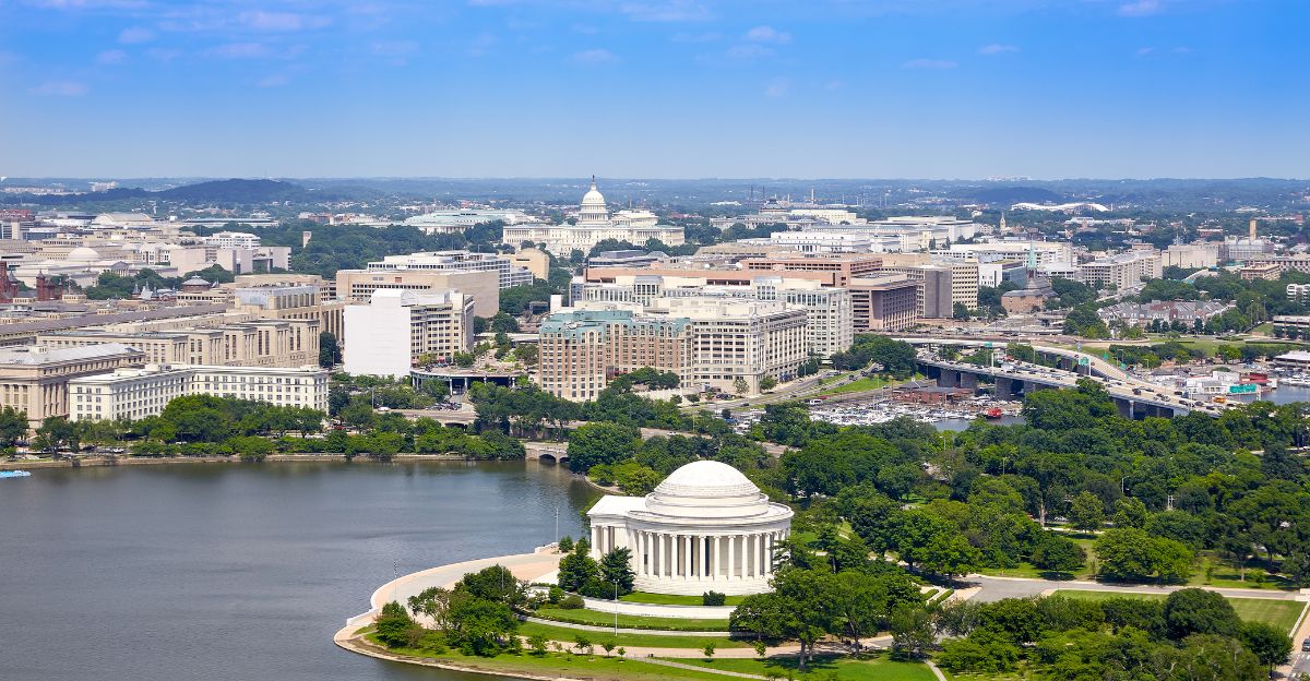
When it comes to the next megatsunami, the greatest risk falls on communities along the Pacific Northwest coast, especially Northern California, northern Oregon, and southern Washington, where millions live within the projected impact zones. Coastal cities like Seattle, Portland, Aberdeen, Seaside, and Eureka could see entire neighborhoods flooded, with some communities having little time to flee. Some areas might have as little as 10 to 30 minutes to evacuate before the tsunami waves arrive.
Some towns might have larger populations but more time to evacuate, while others might be smaller, but the chance of fleeing is very slim. “That allows us to detect the tsunami in the order of 10-15 minutes earlier than the previous generation,” explained Diego Arcas, a research scientist with NOAA’s Center for Tsunami Research.
What History Has Taught Us
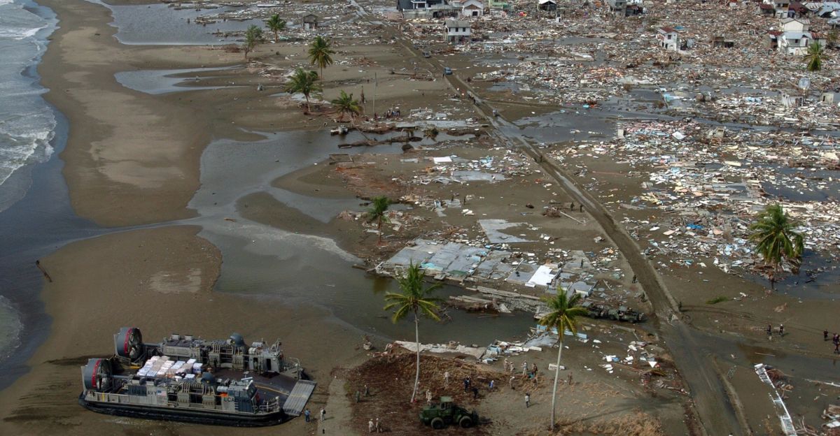
History has its own story to tell to give us an indication of what might happen when this rupture decides to show face. The last major Cascadia earthquake struck on January 26, 1700, with an estimated magnitude of 8.7 and 9.2. That night, entire villages vanished, and a tsunami raced across the Pacific, reaching as far as Japan.
Geological records show at least 13 events in the last 6,000 years, indicating that another is inevitable. The impact of these megatsunamis was big enough to cause serious concern amongst researchers and to keep a close eye on the subduction for any signs of a rupture.
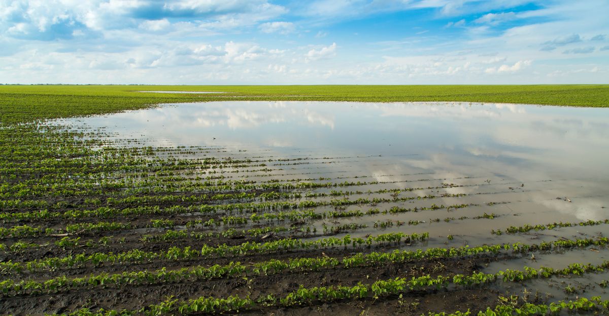
Sinking Coastlines
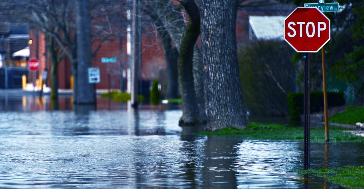
Recent studies reveal that northern California, Oregon, and Washington coastal areas could drop by as much as 6.5 feet within minutes after a major quake, instantly raising local sea levels and dramatically expanding floodplains. The impacts would be immediate and long-lasting, with some communities facing persistent flooding for decades or even centuries as the altered landscape struggles to recover.
“We talk about climate-driven sea level rise, which is occurring at three to four millimeters a year, and that does eventually add up,” Prof Tina Dura. “But here we’ll have two meters of sea level rise in minutes. Why aren’t we talking about that more?”
Emergency Preparedness
For many coastal areas, getting to high ground within 15 – 30 minutes is simply impossible, and that’s why emergency planners are turning to vertical evacuation structures. Washington State has pioneered the construction of these life-saving structures, with the first vertical evacuation tower built by the Shoalwater Bay Indian Tribe and others planned in vulnerable towns like Ocean Shores and Westport.
Studies show that dozens more structures are needed along the coast to ensure everyone in at-risk zones can reach safety quickly, especially in flat, low-lying areas where traditional evacuation routes are inadequate. “There’s just no way for a lot of folks to get to high ground within time,” said Maximilian Dixon, the geologic hazards supervisor for the Washington Emergency Management Division. “It’s not physically possible given the 10 to 15 to 20 minutes before the first wave arrives for that area. So, we’re going to have to build vertical evacuation structures. There’s just no way around it.”
Long-Term Consequences Of The Disaster
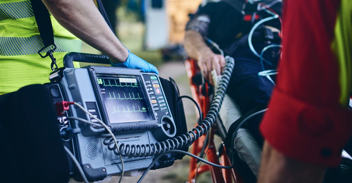
With flooded roads and emergency services unable to get where they need to be, the recovery efforts directly after the event will be challenging. Farmlands will see so much water that their crops will likely not make it. Saltwater intrusion could poison wetlands and agricultural land, causing further economic damage. “Today, and more so in 2100, as background sea levels rise, the immediate effect of earthquake-driven subsidence will be a delayed response and recovery from the earthquake due to compromised assets. Long-term effects could render many coastal communities uninhabitable,” Dura added.
“The loss of intertidal wetlands directly impacts ecosystem services such as water filtration, habitat for fisheries and shorebirds, and carbon storage capacity,” Dura explained. “Intertidal wetlands function as natural carbon sinks, and their erosion or conversion to tidal flats significantly reduces their ability to sequester carbon.”
When Will It Happen?
Researchers cannot pinpoint exactly when this rupture might happen, but looking at past events, it’s clear that it is long overdue. The Pacific Northwest has now surpassed the longest quiet interval seen in over 6,000 years of geological history, making the current period unprecedented.
According to the US National Seismic Hazard Model, there is a 15% chance of an earthquake with an magnitude of 8.0 or greater along the Cascadia Subduction Zone in the next 50 years.
Explore more of our trending stories and hit Follow to keep them coming to your feed!

Don’t miss out on more stories like this! Hit the Follow button at the top of this article to stay updated with the latest news. Share your thoughts in the comments—we’d love to hear from you!


