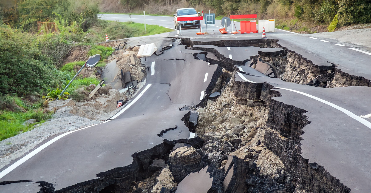
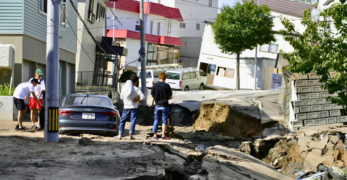
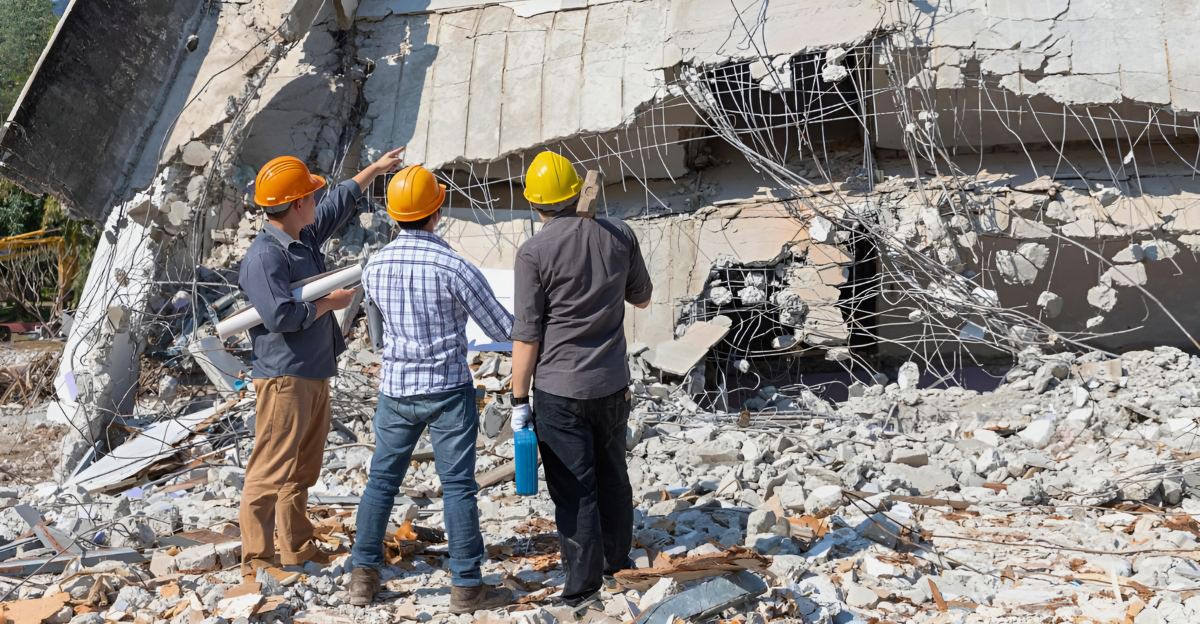
Recent advances in geofluid mapping are revolutionizing our understanding of earthquake mechanisms by revealing how fluids within Earth’s crust influence fault behavior. Identifying earthquake triggers is vital for improving forecasting and mitigating hazards. Fluids such as water and CO2 in fault zones alter pore pressures and rock properties, potentially inducing or inhibiting fault slip.
These insights come from integrating seismic, geochemical, and hydrological data, offering a more detailed picture of how fluid migration interacts with tectonic stresses to trigger earthquakes. Understanding these processes is key to anticipating when and where the next big earthquake might occur.
What Are Geofluids and Why Do They Matter?
Geofluids are fluids like water, carbon dioxide, and other gases trapped within Earth’s crust. They play a crucial role in fault mechanics by changing pore pressure and the physical properties of rocks. Increased pore pressure can reduce friction along faults, making them more prone to slip and generate earthquakes.
Conversely, fluid presence can also strengthen faults under certain conditions. This dual influence means geofluids can trigger and inhibit seismic activity, making their study essential for understanding earthquake dynamics.
Advances in Geofluid Mapping Techniques
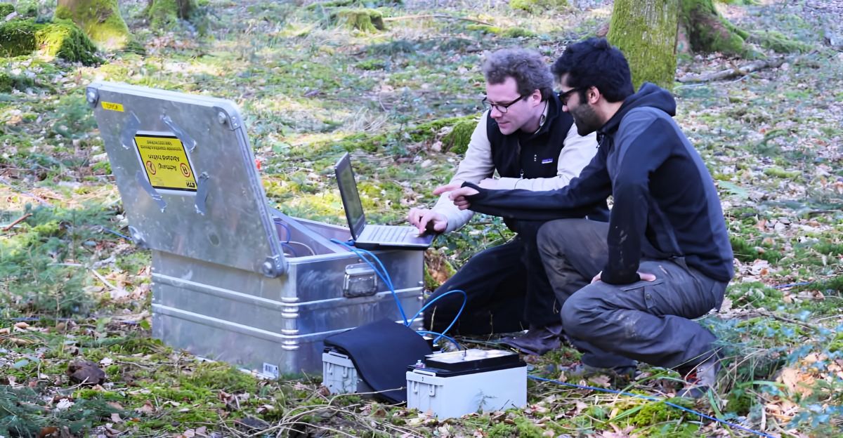
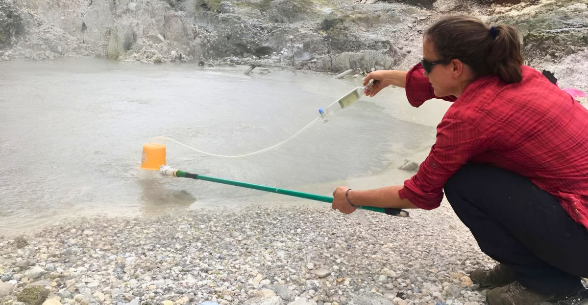
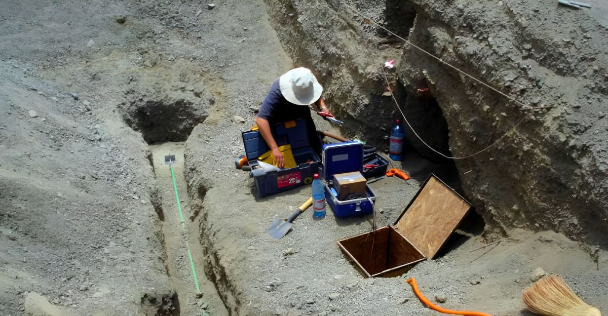
New high-resolution geofluid mapping combines seismic imaging, geochemical analysis, and hydrogeologic measurements to trace fluid pathways in fault zones. These integrated methods reveal how fluids move through fractures and porous rocks, interacting with faults at multiple scales.
Such detailed mapping uncovers the complex fluid flow networks that can weaken or strengthen faults, providing critical data for modeling earthquake processes. These techniques are advancing rapidly, enabling researchers to visualize fluid-fault interactions in unprecedented detail.
Fluids as Earthquake Triggers: The Evidence
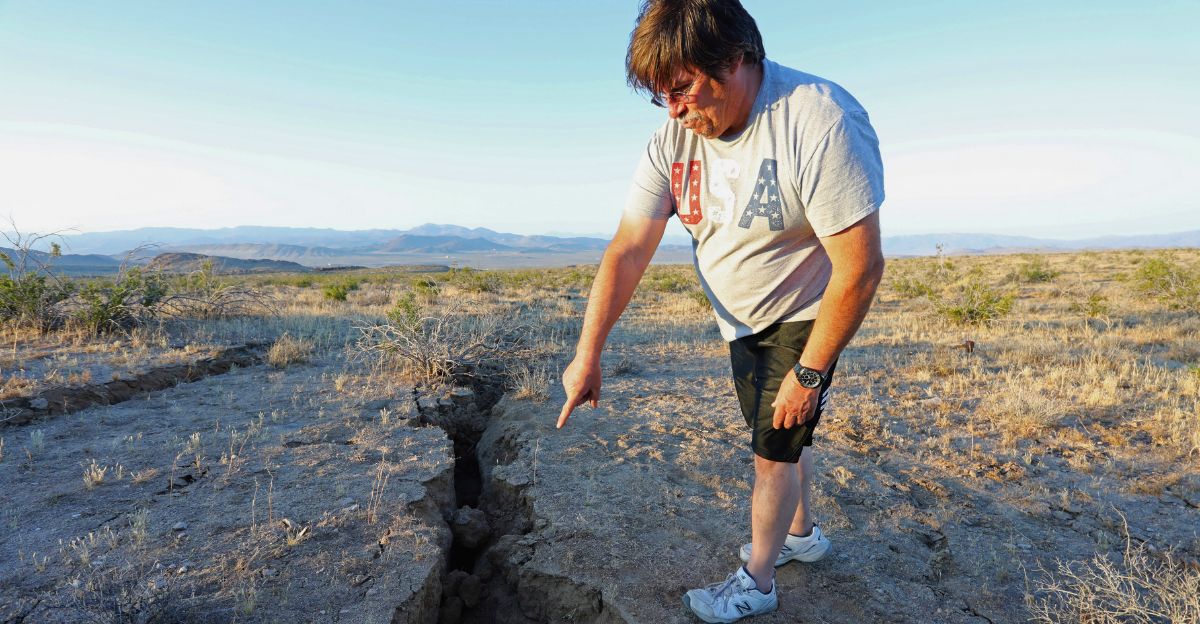
Multiple case studies demonstrate that fluid migration can trigger earthquake swarms, such as those observed in the Main Ethiopian Rift. Seismic patterns often correlate with deep Earth fluid movements, including mantle-derived CO2. Fluids modify crustal stress by increasing pore pressure, which facilitates fault slip.
This mechanism is evident in natural tectonic earthquakes and induced seismicity from fluid injection. The evolving porosity and permeability of fault zones during slip cycles further influence how fluids trigger seismic events.
Contrarian Views and Challenges

Despite promising findings, skepticism remains about using geofluid signals as reliable earthquake precursors. Fluid-rock interactions are complex, and isolating fluid effects from tectonic stress is difficult. Current monitoring technologies and forecasting models have limitations, often failing to predict earthquakes accurately.
The heterogeneous nature of faults and variable fluid behaviors challenge the development of universal predictive models. Thus, while fluids are essential, they represent only one piece of the earthquake puzzle.
Surprising Intersections with Other Fields
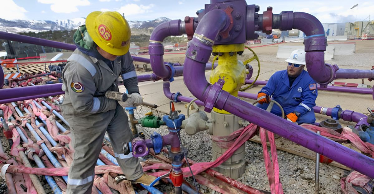
Industrial activities like hydraulic fracturing and wastewater injection have shown how human-induced fluid injection can trigger earthquakes, highlighting a direct link between energy sector practices and seismicity. This intersection offers opportunities for environmental monitoring to contribute valuable data for earthquake research.
Understanding induced seismicity helps refine natural earthquake models and informs regulations to reduce seismic risks associated with industrial fluid injections.
Historical Context of Earthquake Precursors
Earthquake precursor research spans over 2,500 years, beginning with early observations of groundwater changes and electromagnetic signals before quakes. These early insights laid the groundwork for modern geofluid monitoring and probabilistic hazard mapping.
Over centuries, the focus has shifted from anecdotal evidence to sophisticated, multidisciplinary approaches combining geology, geochemistry, and geophysics to detect subtle pre-earthquake signals related to fluid movements.
Current Statistics and Expert Opinions
Recent studies document increased rates of earthquake swarms linked to fluid migration, highlighting the growing recognition of fluids in seismicity. Experts acknowledge the potential of geofluid-based forecasting but emphasize current limits due to data gaps and model uncertainties.
Some predictions based on fluid signals have succeeded, while others have failed, underscoring the need for cautious interpretation and further research to improve reliability.
The Road Ahead: Future Research and Applications

Future research aims to develop real-time geofluid monitoring technologies and integrate multidisciplinary data, including machine learning, to characterize fault zones better. Coupling geophysics, geochemistry, and hydromechanical modeling promises improved earthquake forecasting accuracy.
These advances could enhance early warning systems, providing critical lead time for disaster preparedness. Continued innovation is essential to unravel the complex fluid-fault interactions that govern seismic hazards.
When’s the Next Big One?
Geofluid mapping enriches our understanding of earthquake triggers but does not yet allow precise prediction of the next major quake. Ongoing research seeks to integrate fluid data with seismic monitoring to improve forecasting capabilities. While the exact timing remains uncertain, recognizing fluid influences on faults underscores the importance of preparedness and hazard mitigation.
The timing of the next big earthquake is still unpredictable, but advances in geofluid science bring us closer to anticipating seismic risks more effectively.
Explore more of our trending stories and hit Follow to keep them coming to your feed!

Don’t miss out on more stories like this! Hit the Follow button at the top of this article to stay updated with the latest news. Share your thoughts in the comments—we’d love to hear from you!


