
Imagine waking up to see much of the Pacific Northwest’s landscape suddenly and dramatically changed, with coastal towns flooded, saltwater filling in, and entire neighborhoods under water. Although it sounds like the plot of a science fiction novel, evidence is mounting that such a scenario is not only possible but growing more likely.
The threat stems from a geological giant that has been silently building pressure for centuries, hidden beneath the waves a few miles off the coast. For most residents, the concept of the ground collapsing is nearly unimaginable — after all, earthquakes conjure up images of shaking, not the land opening up and dropping out from beneath your feet.
But this is precisely the sort of disaster that very likely could occur, geologists say, with consequences that would ripple across communities, economies, and ecosystems throughout the region.
A Fault Line with Catastrophic Potential
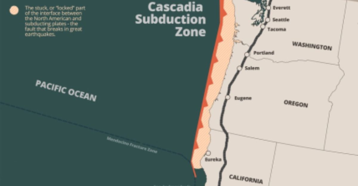
The Cascadia Subduction Zone is an enormous fault line, stretching from Northern California to British Columbia, and is capable of producing some of the world’s most powerful earthquakes.
This 700-mile-long megathrust fault is the zone where the Juan de Fuca Plate is gradually being forced under the North American Plate, resulting in massive energy buildup that, when released, could trigger unprecedented destruction.
Why the Stakes Are Rising

What makes this fault particularly alarming is more than just the possibility of a massive earthquake. However, it’s also the risk the land itself will sink. Recent studies have warned that a Cascadia quake could cause coastal land to sink by as much as 6.5 feet in a matter of minutes.
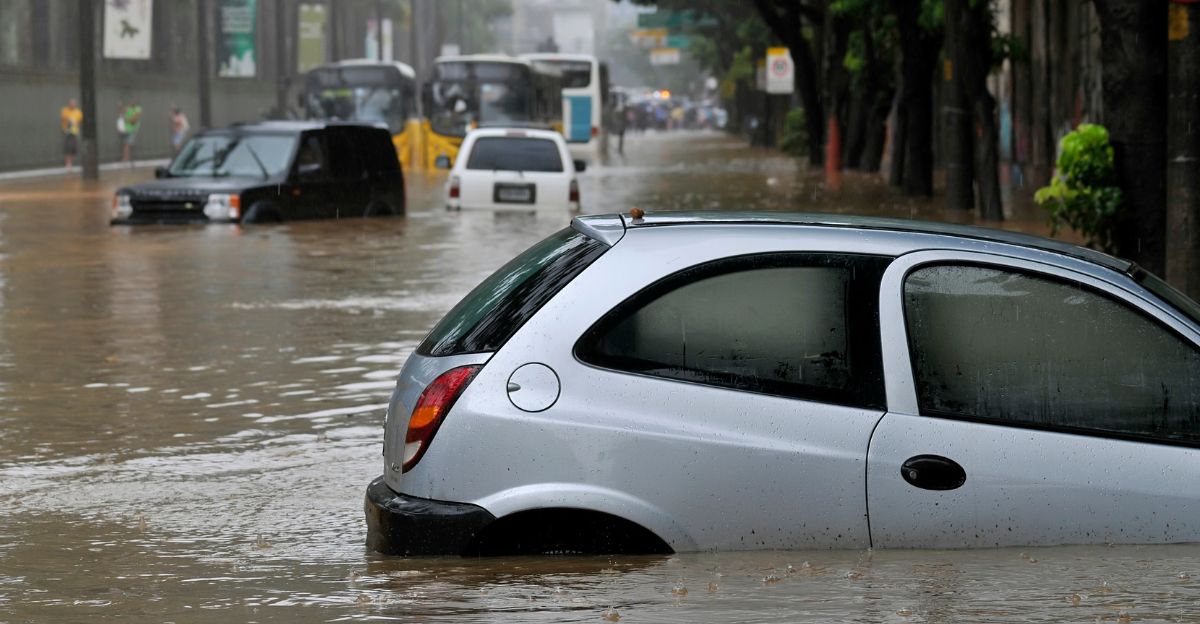
This rapid sinking would immediately increase the size of the area’s floodplain, and potentially leave thousands of people and properties at risk of permanent inundation.
A Disaster Unlike Any Other
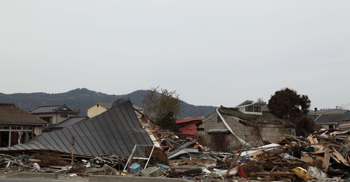
Unlike the temporary havoc of a tsunami, the sinking of the land after a Cascadia quake would be permanent. Experts describe this as experiencing centuries’ worth of sea level rise in just minutes.
The result? Airports, highways, wastewater plants, and entire neighborhoods could all find themselves below sea level, with floodwaters that never recede.
The Science Behind the Sinking
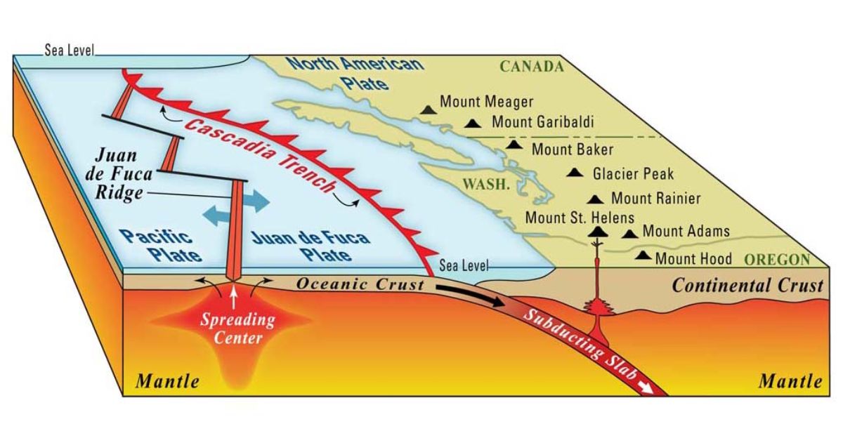
The process is rooted in the mechanics of subduction zones. When the plates finally do slip, the overriding plate snaps downward like a released spring, causing the ground to drop suddenly.
This effect has been observed in previous events such as the 1700 Cascadia earthquake, where there is geological evidence of coastal wetlands sinking by up to six feet.
Towns Most at Risk
Communities like Crescent City in California and Seaside in Oregon are among the most at risk. These low-elevation coastal towns are especially vulnerable not just to the land sinking but also to the flooding that comes with it.
Authorities warn that, in a worst-case scenario, key infrastructure could be rendered useless in a matter of minutes, thereby hampering swift and effective response and recovery.
The Human and Economic Toll
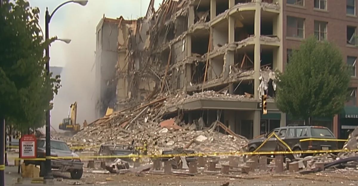
The ramifications are huge. In Oregon, estimates suggest that a Cascadia quake could cause $32 billion or more in damage. The death toll could be anywhere from hundreds to thousands, with tens of thousands of people left homeless.
Essential services—water, electricity, healthcare—could be down for months or even years, and recovery will be hindered by its permanently altered landscape.
Why Preparation Lags Behind

Despite the mounting evidence and urgent warnings from scientists, many communities in Oregon and Washington are ill-prepared. Unlike California, which has poured billions into seismic safety, some corners of the Pacific Northwest have been slow to follow up-to-date building codes, update evacuation plans, and otherwise prepare residents for when, not if, the next big one comes.
What Can Be Done Now

There’s hope, but it requires action. Local governments have started to update tsunami evacuation maps, strengthen infrastructure, and construct vertical evacuation towers.
Public-education campaigns are meant to ensure residents are prepared to know what to do when the shaking begins. But experts say a great deal more needs to be done to prepare for a disaster that could reshape the region for generations.
The Unsettling Reality Ahead
So, is it really possible that a megaquake could sink portions of the Pacific Northwest? Geologists’ answer to that is yes. While not every inch of coastline will disappear, enough land could drop and flood to redraw maps and destroy communities.
It’s not only a possibility—it’s a matter of time. The region stands at a crossroads and the opportunity to get ready for a future that—if ignored, could become a disaster movie come to life.
Explore more of our trending stories and hit Follow to keep them coming to your feed!

Don’t miss out on more stories like this! Hit the Follow button at the top of this article to stay updated with the latest news. Share your thoughts in the comments—we’d love to hear from you!


