
Mount Spurr, an 11,070-foot-high volcano in Alaska, has triggered widespread concern as scientists warn of an imminent eruption. This volcano, situated 81 miles from Anchorage, has shown alarming signs of activity, including over 3,400 earthquakes recorded since April last year. Authorities have issued emergency alerts for 300,000 residents, urging them to prepare for potential ash clouds, toxic gases, and explosive eruptions.
History of Mount Spurr’s Eruptions
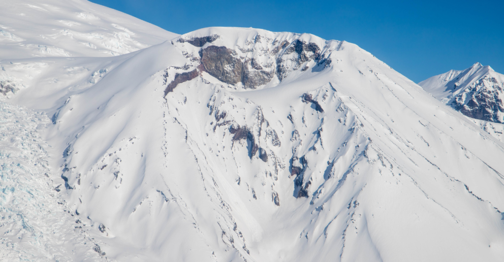
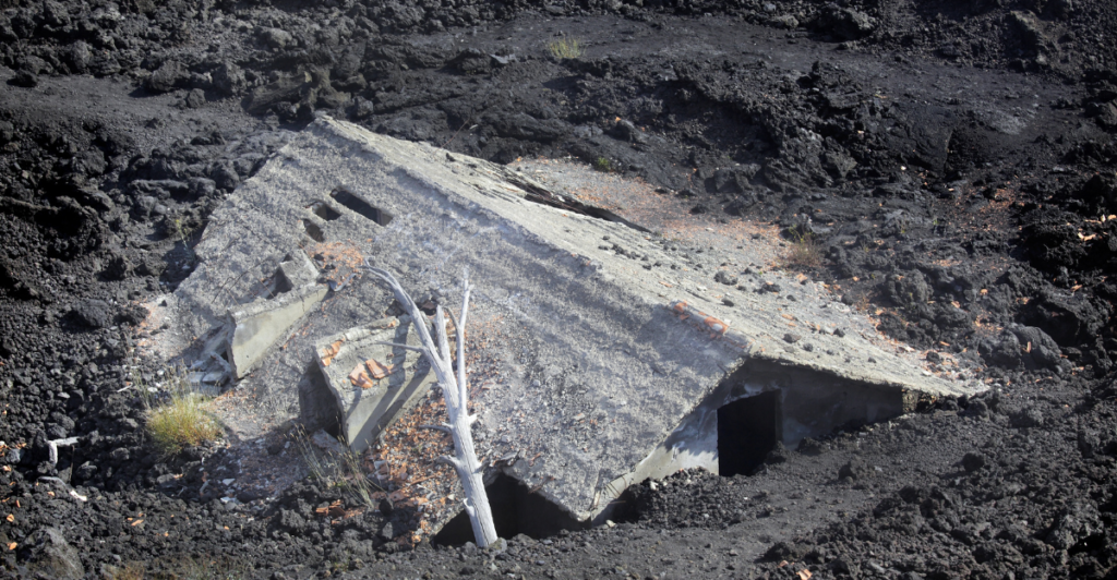
Mount Spurr is a stratovolcano located approximately 80 miles west of Anchorage that has a long and dramatic history of eruptions spanning over 10,000 years. While many of its eruptions remain undocumented, two notable events have left significant marks on the region. The first occurred in July 1953 when Crater Peak, a vent at the southern end of the volcano’s caldera, erupted explosively, sending ash clouds over 50,000 feet into the atmosphere and depositing ash across Southcentral Alaska.
Nearly four decades later, in June 1992, Crater Peak erupted again in a three-month series of explosive events. Ashfall from this eruption caused widespread turmoil for residents and temporary shutdowns of airports and schools.
Current Status and Alerts
Mount Spurr is under heightened scrutiny as the Alaska Volcano Observatory (AVO) reports significant signs of unrest, including elevated volcanic gas emissions, increased seismic activity, ground deformation, and surface heating. “We expect to see further increases in seismic activity, gas emissions and surface heating before an eruption, if one were to occur,” the observatory said. “Such stronger unrest may provide days to weeks of additional warning.”
The volcano’s alert level has been raised to “Advisory,” the aviation color code remains yellow, signaling elevated activity above background levels. Experts anticipate that further warning signs, such as stronger seismic events and intensified surface changes, could provide days to weeks of notice before an eruption.
Seismic Activity Under Mount Spurr
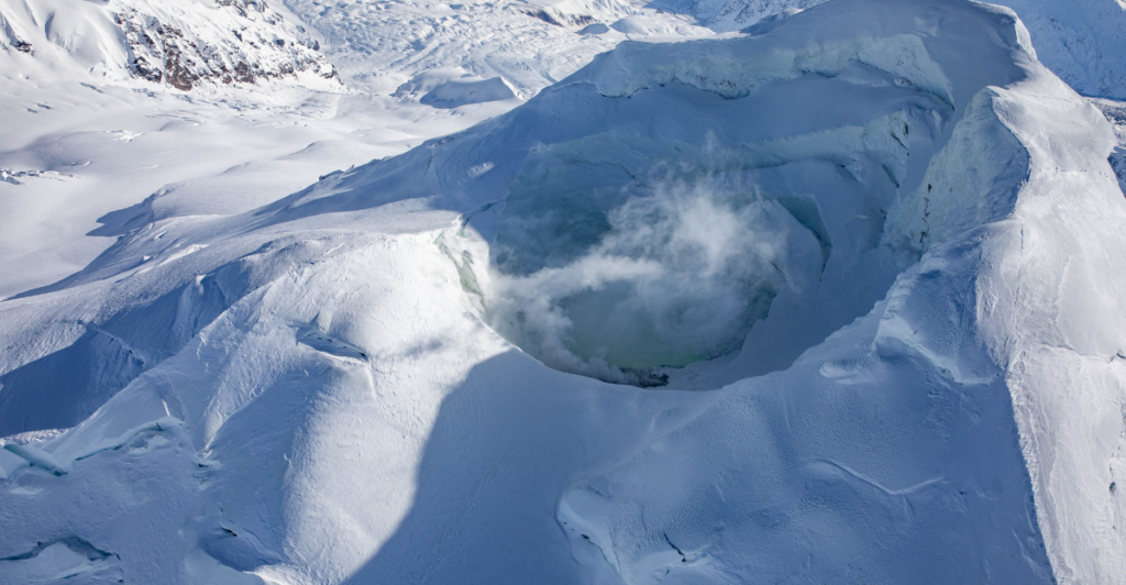
Seismic activity beneath Mount Spurr has intensified significantly over the past year, signaling potential volcanic unrest. Since April 2024, over 3,400 earthquakes have been recorded under the volcano, with clusters concentrated at depths ranging from shallow (0–10 km) to deeper levels (12–22 km) beneath the summit and Crater Peak vent.
Recent data reveals that most earthquakes remain small, with magnitudes peaking at M2.9, yet their frequency and distribution suggest magma movement within the crust. Ground deformation has also been observed, with inflation measurements indicating a source located 3–5 km below sea level and west of the summit.
Potential Impacts of an Eruption
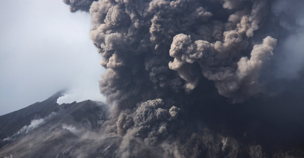
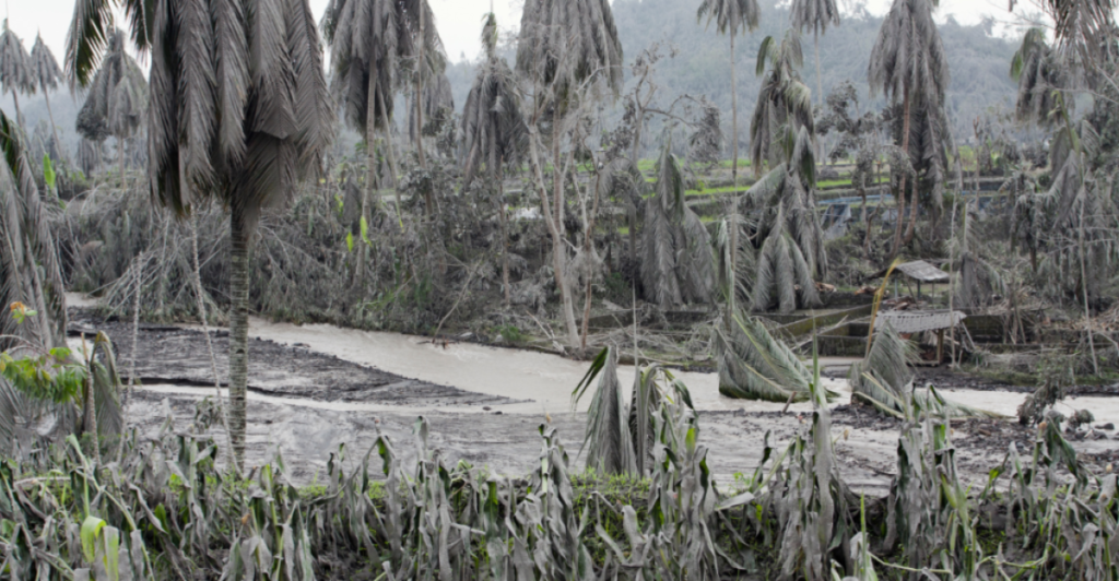
An eruption is extremely unpredictable and can produce nothing good. The primary concern is volcanic ashfall, which, depending on wind patterns, can blanket communities like Anchorage and Kodiak. Ashfall as thick as 1/4 inch could disrupt daily life, damage infrastructure, and pose health risks, particularly for individuals with respiratory conditions.
Air travel would likely face significant disruptions, as ash clouds can damage aircraft engines and lead to airport closures, similar to the 1992 eruption that grounded flights for hours. Road conditions could become hazardous due to slippery ash deposits, and utility systems may suffer from clogged air filtration equipment. In the event of an explosive eruption, pyroclastic flows and mudflows could devastate areas near the volcano, though these regions are largely uninhabited.
Monitoring Efforts by Scientists
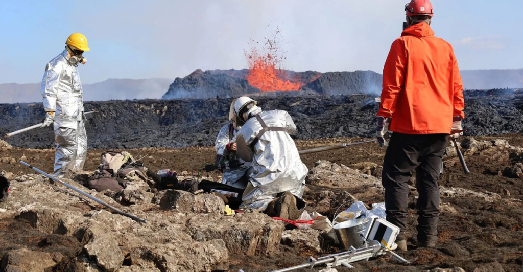
Scientists at the Alaska Volcano Observatory (AVO) use an extensive monitoring tool network to track Mount Spurr’s activity in real-time. This includes seismic stations to detect earthquakes, infrasound sensors to capture low-frequency sounds from eruptions, and satellite imagery to monitor surface changes and gas emissions. Recent overflights have measured elevated sulfur dioxide (SO2) and carbon dioxide (CO2) levels, while ground-based instruments have recorded ongoing surface deformation and volcanic gas venting.
Although snow and ice occasionally obscure webcams, these tools allow scientists to detect early warning signs, such as increased seismicity or ground inflation, that typically precede eruptions. The AVO wrote, “Unrest continues at Mount Spurr volcano. Seismicity remains elevated with occasional small, shallow volcanic earthquakes detected beneath the volcano over the past day.”
Preparation Measures for Residents

The Alaska Volcano Observatory (AVO) has advised residents to prepare for ashfall ranging from one-eighth to a quarter-inch, prompting many to assemble comprehensive disaster supply kits. These kits should include two weeks’ worth of nonperishable food and water, flashlights, and cellphone chargers. Residents are also encouraged to obtain specialized supplies for volcanic eruptions, such as N95 masks for respiratory protection, vehicle air filters to prevent engine damage, and plastic sheeting to protect homes and properties.
The state has launched a centralized resource hub at ready.alaska.gov/volcano, offering real-time updates, pet care guidance, and vehicle maintenance recommendations. Residents are also advised to sign up for volcano notifications through the U.S. Geological Survey’s Volcano Notification Service. Specific recommendations for those living in military housing include keeping windows and doors closed to prevent ash entry, having extra air filters on hand for forced air units, and staying informed through JBER Connect and the JBER website.
Comparison with Other Active Volcanoes
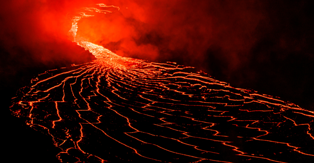
Mount Spurr is not the only volcano under watch in the U.S. Great Sitkin in Alaska and Kilauea in Hawaii have also shown signs of unrest recently. Kilauea erupted earlier this week, shooting lava over 300 feet into the air. Mount Spurr shares traits within Alaska with other Aleutian Arc volcanoes, such as Redoubt and Augustine, which have also exhibited explosive eruptions and significant ashfall events impacting aviation and local communities.
Their volcanoes are unpredictable, and the magma always moves below the surface. Researchers can track these movements, but there would be very little to no warning in the case of an explosion.
Health Risks from Volcanic Ash
When inhaled volcanic ash, fine ash particles can penetrate deep into the lungs, causing immediate and long-term health effects. Acute respiratory symptoms include nasal irritation, sore throat, coughing, wheezing, and shortness of breath. For individuals with pre-existing respiratory conditions such as asthma or chronic obstructive pulmonary disease (COPD), exposure to volcanic ash can exacerbate their symptoms, potentially leading to increased emergency room visits and hospitalizations.
The eyes are also vulnerable to ash exposure, with potential symptoms ranging from irritation and redness to more severe conditions like corneal abrasions and acute conjunctivitis. Studies have linked such exposure to the development of chronic respiratory conditions, including bronchitis, lung disease, and even lung cancer. The presence of crystalline silica in some volcanic ash can increase the risk of silicosis, a serious lung disease, especially with extended exposure.
Staying Prepared Amid Uncertainty
Staying prepared in situations like these is the best thing we can do. Volcanic eruptions can escalate rapidly, and while monitoring efforts provide valuable early warnings, the exact timing and scale remain difficult to predict. This uncertainty means that communities must maintain a state of readiness by regularly updating emergency plans, keeping disaster supplies accessible, and staying informed through official channels like the Alaska Volcano Observatory and local emergency management agencies.
Explore more of our trending stories and hit Follow to keep them coming to your feed!

Don’t miss out on more stories like this! Hit the Follow button at the top of this article to stay updated with the latest news. Share your thoughts in the comments—we’d love to hear from you!


