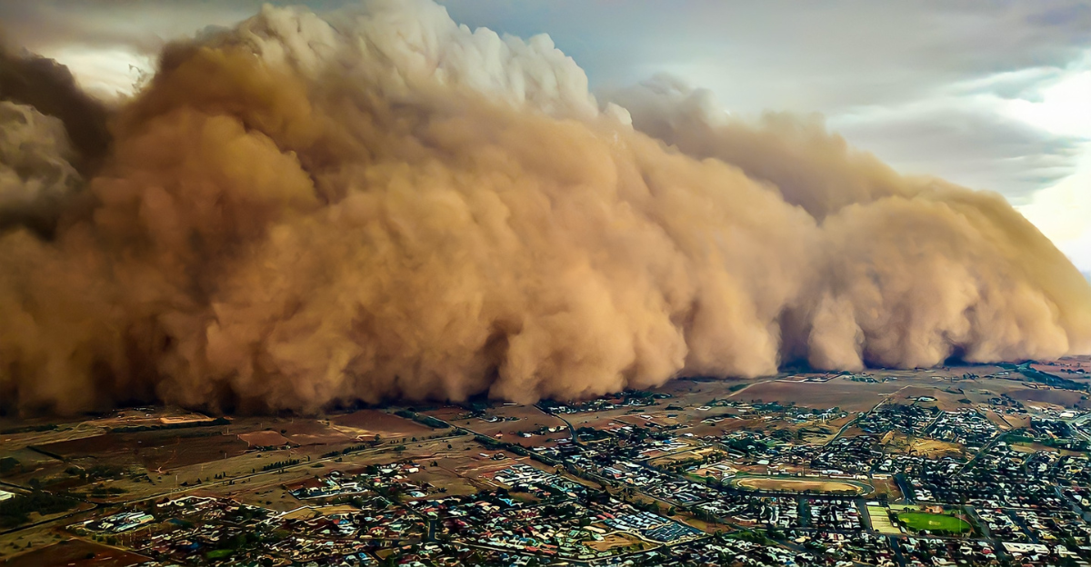
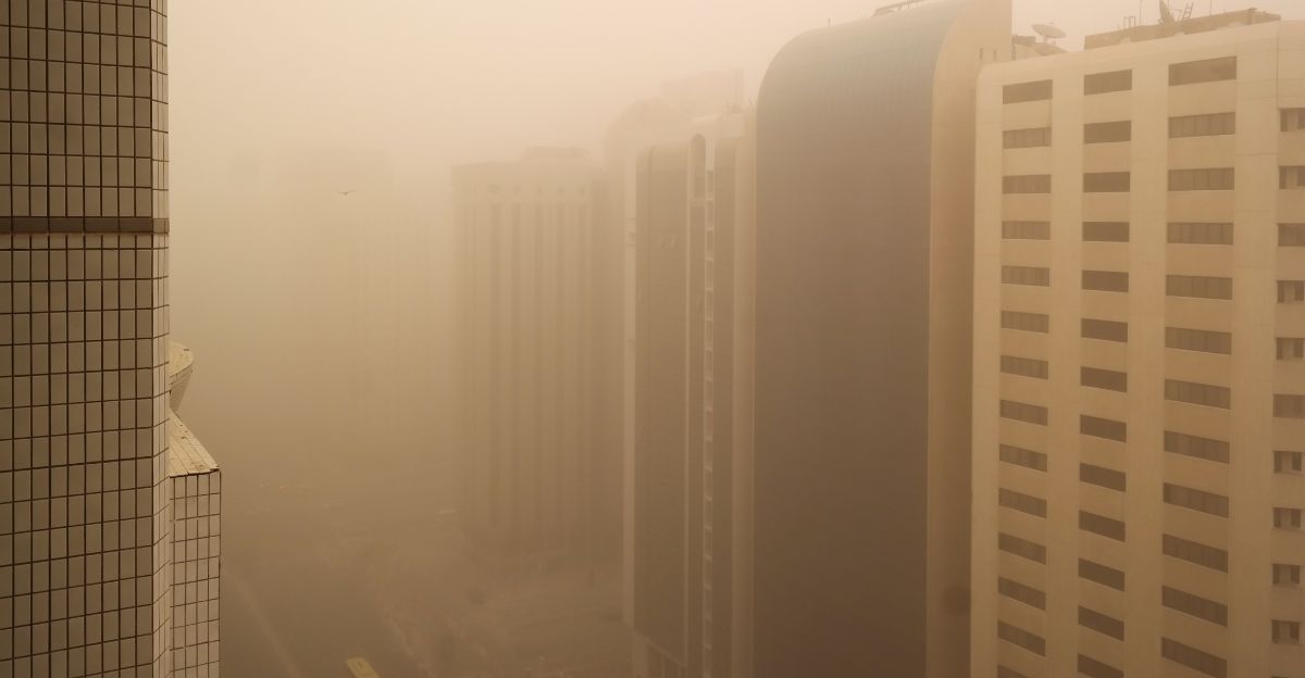
Seeing a massive dust cloud rolling your way might not be a regular event in the U.S., but it isn’t impossible. The Sahara Desert has been kind enough to share some of its experiences with citizens of the United States, but it won’t be a pleasant one. This enormous plume is one of the largest observed this year. It will impact Florida before spreading along the southern U.S. coastline, potentially affecting a huge junk of the region with hazy skies and diminished air quality.
How the Dust Cloud Travels Across Oceans
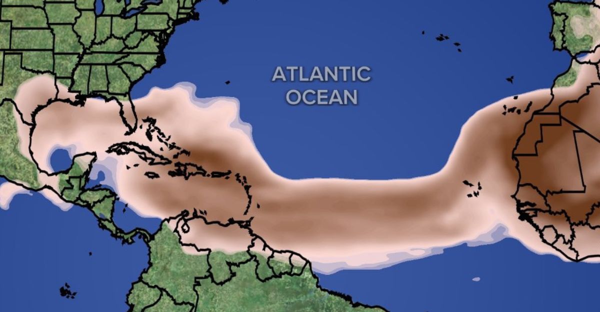
These dust plumes from North Africa’s Sahara Desert are swept into the upper atmosphere by strong surface winds, forming the Saharan Air Layer. This dry, hot air mass can reach heights of up to 2.5 miles. Once up there, the dust rides the easterly trade winds, which propel it westward across the Atlantic Ocean at 15–25 mph speeds. These dust storms can travel over 5,000 miles at this pace, usually taking 5-10 days to land.
“It happens every year; some years have more dust transportation across the Atlantic than others,” explains Sammy Hadi, a meteorologist at the National Weather Service office in Miami. “It’s like rinse and repeat every year; it’s part of a normal cycle of Earth’s oscillations.”
The Science Behind the Saharan Dust Plume
This mind-blowing, for a lack of better words, starts with the mesoscale convective systems (MCS) over the Sahara, where thunderstorms generate powerful downdrafts that collide with the desert surface, creating cold pool outflows. These dense, fast-moving air masses can lift dust through wind speeds exceeding 15 m/s.
Once in the air, these particles are carried into the Saharan Air Layer, where they catch a ride along the African Easterly Jet. Nocturnal low-level jets further enhance dust mobilization by mixing momentum from upper winds to the surface overnight. With a mix of wind types and temperatures, these dust clouds can travel quite a distance without losing momentum.
Satellite Imagery Reveals the Plume’s Immensity
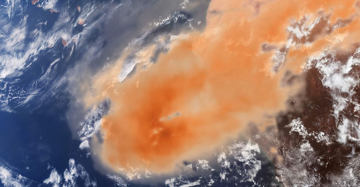
Satellite imagery has shown just how beastly this Saharan dust plume truly is. On May 7, 2025, the Copernicus Sentinel-3 satellite captured a dense, orange cloud stretching over approximately 57,915 square miles, leaving the Cabo Verde islands barely visible beneath the dust.
Sentinel-5P, equipped with advanced aerosol-detecting technology, overlaid additional data to show the plume’s aerosol concentrations, using darker orange tones to indicate denser dust regions and helping scientists assess the event’s size and intensity.
Not the First, but Among the Largest
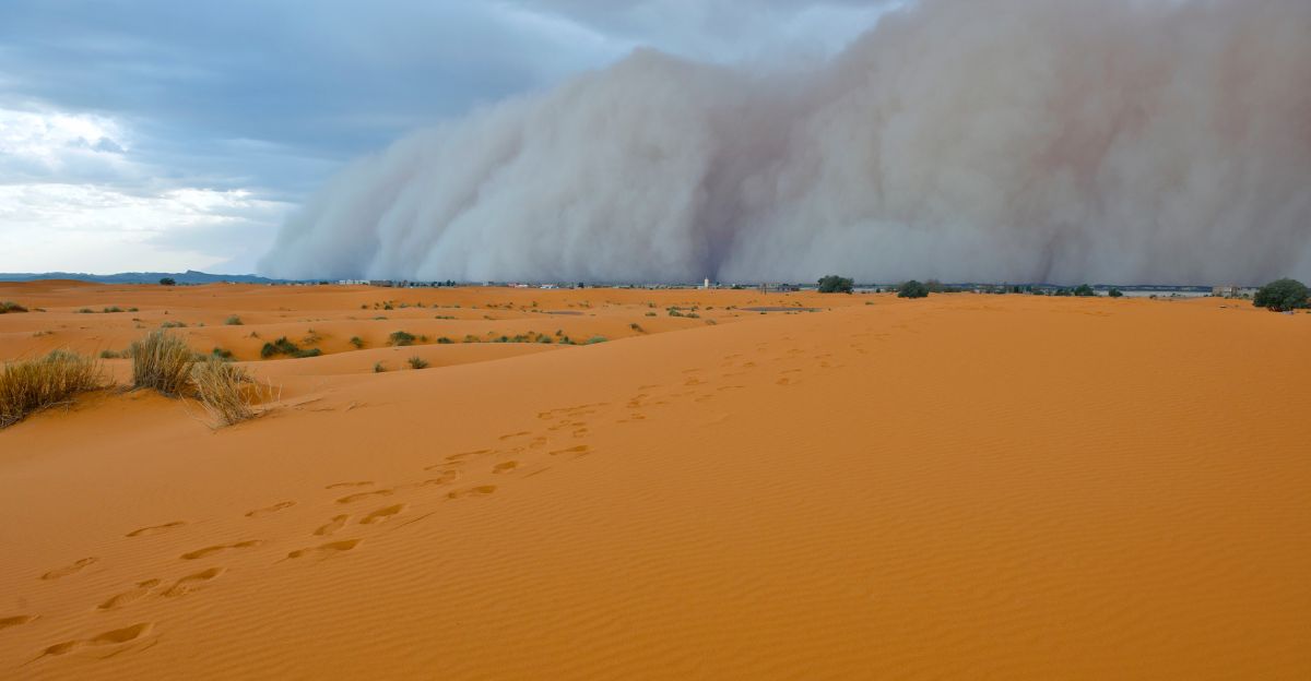
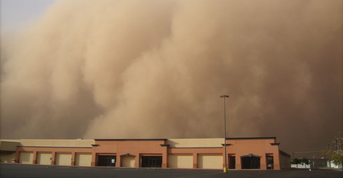
The current dust cloud headed for the Gulf Coast is not the first of its kind, but it stands out as one of the largest events set to hit the coast. These dust plumes have been a natural phenomenon for as long as time can tell, with the Sahara Desert annually producing between 400 and 700 million tons of dust. Most of this dust is transported across the Atlantic to cause chaos in other countries.
“This is the biggest Saharan dust plume that we’ve seen so far this year.’ said Alex DaSilva, lead hurricane expert for AccuWeather. Events like the 2020 “Godzilla” dust plume stretched over 5,000 miles and blanketed the southeastern United States. Research shows that these events have steadily grown in occurrence, size, and impact.
When Will It Make Landfall?
This dust plume will reach Florida first, with meteorologists forecasting its arrival by early Wednesday, June 4, 2025. From there, the dust will spread across much of the Southeast and the Gulf Coast over the following days, with hazy skies and reduced visibility anticipated in states like Louisiana, Alabama, Mississippi, and Texas by the weekend.
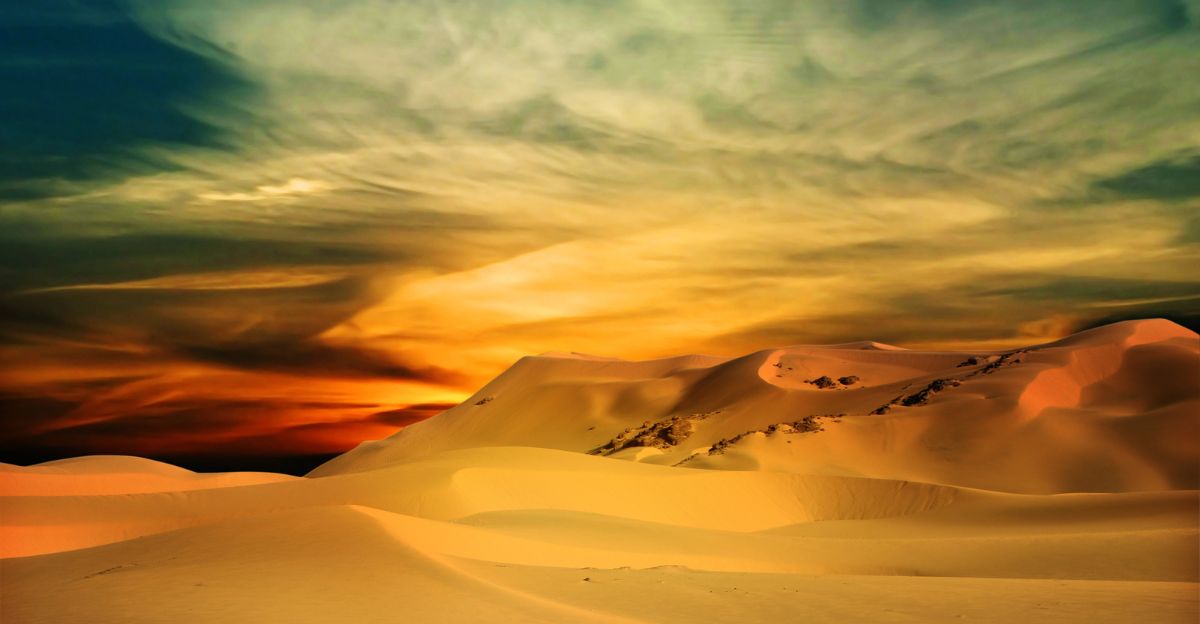
While the dust is likely to create strikingly colorful sunrises and sunsets, health experts advise caution for those with respiratory issues, as the fine particles may temporarily affect air quality. “Many people will notice more colourful sunrises and sunsets, and a milky or hazy look in the sky,” said DaSilva.
Air Quality Concerns and Health Risks

When news of these plumes spreads fast, air quality concerns rise, especially for vulnerable populations. The dust contains extremely fine particles, primarily minerals like quartz and silicates, that can be inhaled deep into the lungs, potentially causing irritation and exacerbating respiratory conditions.
Health risks are heightened for children, older people, and those with pre-existing lung or cardiovascular issues, as these groups are most susceptible to increased particulate matter in the air.
Staying Safe During the Dust Outbreak

These dust storms might not be the end of the world, but it’s important to stay safe during them. Minimize exposure by staying indoors as much as possible, especially for those with respiratory conditions, children, and the elderly. Keep windows and doors closed to prevent dust from entering your home, and use the air conditioning set to recirculate mode to maintain cleaner indoor air.
Check air quality reports regularly and follow local health advisories for the latest updates and recommendations. “I always recommend folks check with their local experts. But with that dust, folks with asthma, the elderly, can be slightly more prone when these dust outbreaks come through,” said Hurricane scientist Jason Dunion.
Environmental and Ecological Effects

As the dust traverses the Atlantic, it delivers essential nutrients such as iron and phosphorus to ocean and land ecosystems, fertilizing phytoplankton and replenishing soils in the Amazon rainforest, where phosphorus is otherwise limited.
This nutrient influx can stimulate primary production, supporting marine food webs and influencing global carbon cycles by enhancing the growth of photosynthetic organisms that draw down atmospheric CO₂.
More Dust Plumes Expected
The arrival of a dust cloud the size of 48 states is a dramatic reminder of our interconnected planet. These so-called “dust reinforcements” are predicted to follow a similar path, arriving in the easternmost Caribbean islands and Puerto Rico by early next week before potentially impacting South Florida and the broader Gulf region yet again.
These major events might not be as common as other natural phenomena, but they greatly impact the environment and its inhabitants.
Explore more of our trending stories and hit Follow to keep them coming to your feed!

Don’t miss out on more stories like this! Hit the Follow button at the top of this article to stay updated with the latest news. Share your thoughts in the comments—we’d love to hear from you!


