Florida residents are watching the weather closely this week as predictions suggest potential tropical trouble. A system circulating in the general area is being watched, and authorities are reassessing the magnitude of the threat on a daily basis.
Most residents are used to summer storms, but the potential for a named system approaching early in the season is causing panic. What’s happening, and what should locals watch for in the coming days?
A Growing Issue
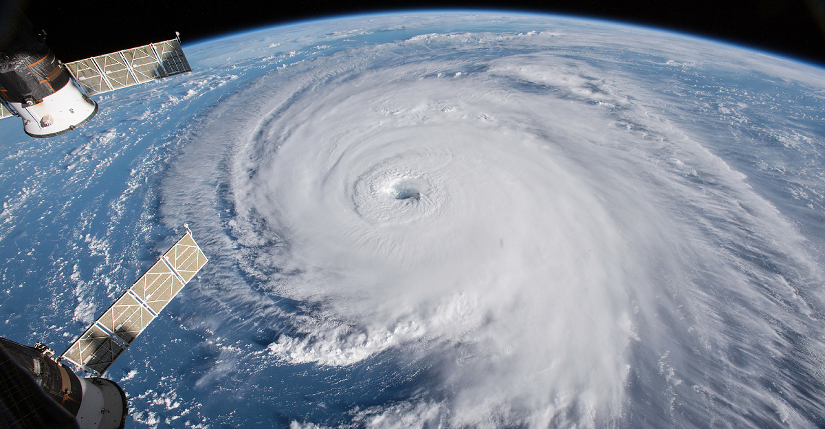
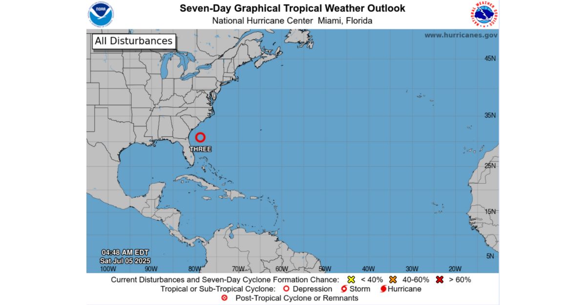
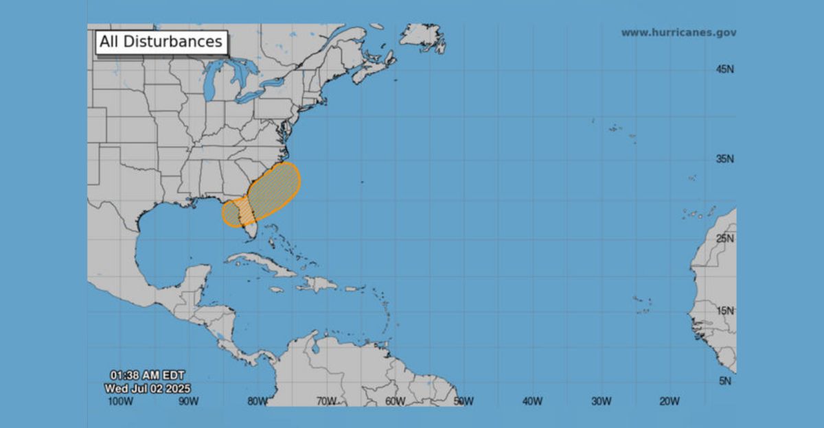
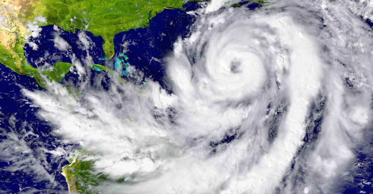
Weather forecasters have been monitoring a disturbance off the southeast coast of the United States. In a matter of days, the probability of it becoming a tropical system are growing.
The National Hurricane Center (NHC) had recently raised its probability of development from 20 percent to 30 percent and now 40 percent. This has residents and officials monitoring it more closely, because vacation holidays are potentially at stake.
Where It’s Brewing
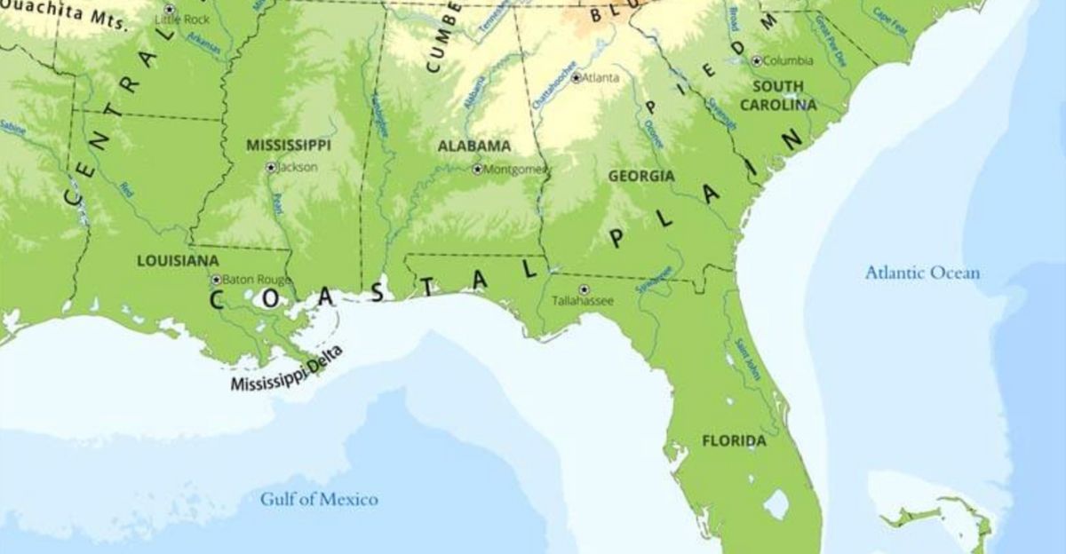
This possible system is developing along the Atlantic and Gulf coasts of the southeast United States. A weak frontal boundary over the region may provide just enough impetus to get it going.
Conditions are not optimal, but they are good enough to allow for slow development. If it evolves, it might head toward Florida’s west coast initially, but the direction is unclear at this stage. Area residents should stay informed.
A New Name on Deck
If the system becomes a tropical storm, it will be called Chantal. This would be the season’s third Atlantic-named storm, following Andrea and Barry. Andrea remained off the coast, and Barry had only just come ashore in Mexico.
It does not necessarily indicate heavy impact when a system is named, but it does mean that it has attained a level of strength that needs close attention.
Timing and Movement
Specialists predict that it will be over the weekend or early next week if it develops further. The system is moving slowly and may remain near the coast.
A few models indicate little movement before a possible expansion towards Florida. Rain is possible, which may also affect local events and daily routines.
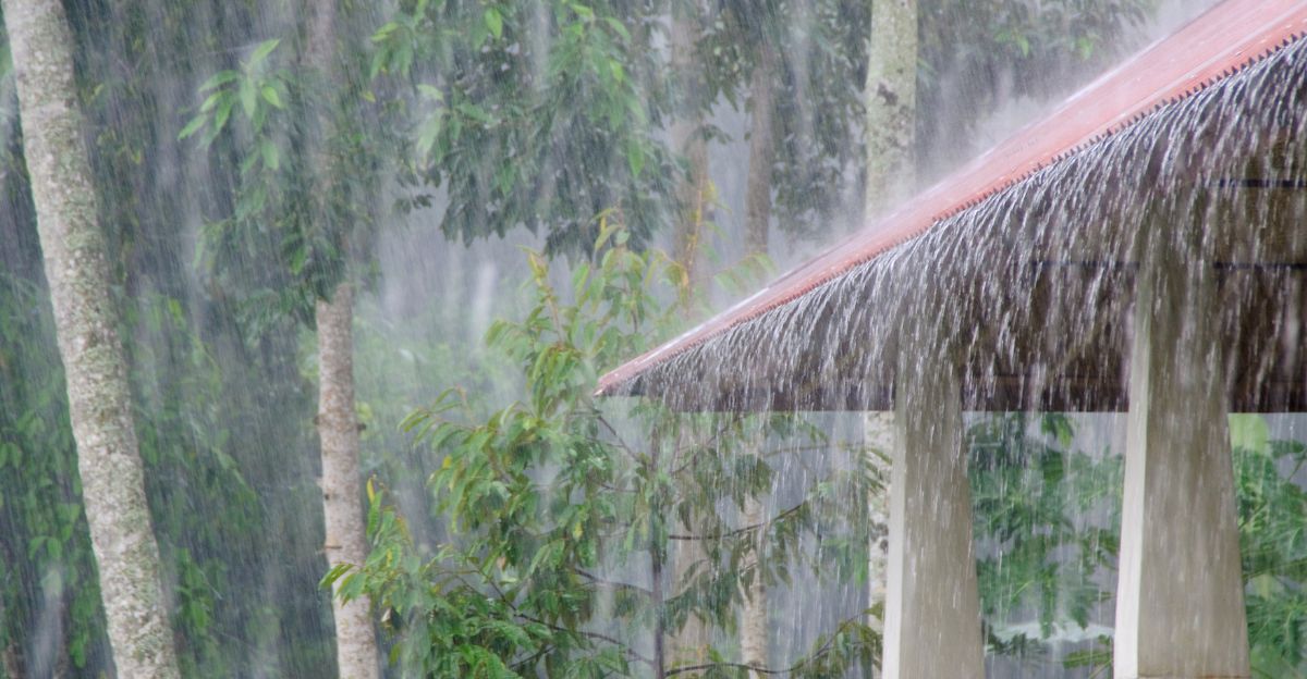
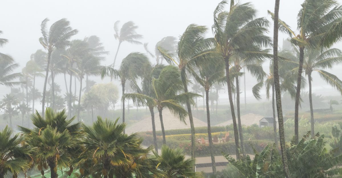
Fourth of July Dampened
This Fourth of July in Florida was more damp than festive. Heavy rain bands of the wide-sweeping disturbance passing over the Gulf and Atlantic coasts delivered typical downpours.
Firework displays were delayed or cancelled outright, and beach parties dwindled as storms swept through. Although no vigorous tropical storm did materialize, the torrential rain still produced scattered flooding and traffic jams.
Floridians had to forego outdoor barbecues in favor of indoor parties, illustrating how even a weak system can ruin holiday plans, as stated by the National Weather Service and other news reports.
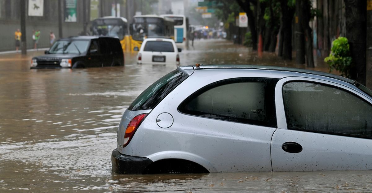
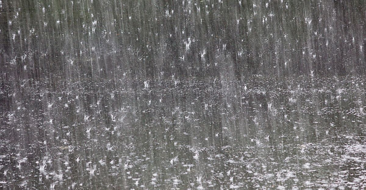
Rainfall Risks
Aside from possible wind, the most significant issue with this system is heavy rain. More flooding of low-lying and coastal areas is highly possible.
Even without a full-fledged storm, the rain from the disturbance can flood streets and inundate drainage systems with water. Emergency response professionals are waiting on the sidelines, and residents are advised to install sandbags and review local flood plans.
Warm Waters Help
Along the Florida coast, ocean temperatures are warm enough to support tropical development. Warm water is fuel for such systems, enabling them to form and remain potent.
Though forecasters suggest rapid intensification is not currently in the picture, warm Gulf and Atlantic waters cannot be ruled out. For this reason, experts are closely monitoring the situation, especially as we move deeper into hurricane season.
Marginal Conditions
The NHC has also indicated that conditions are only “marginally conducive” to development. In other words, some conditions favor growth, but others inhibit it.
More wind shear or drier air may prevent the system from growing further. However, even a weak tropical cyclone can still produce heavy rain and strong winds, so officials remain on guard.
Public Alerts

Local governments and the NHC have been posting advisories on social media and government websites. On Twitter, now known as X, the NHC tweeted about increasing probabilities and requested people remain aware.
Early warnings allow people to be ready without the panic. Emergency managers emphasize that being prepared today can save a last-minute mad dash for supplies in case situations worsen later.
Local Reactions

Storm warnings are routine in Florida, but even long-time residents get cautious with each new system. Grocery stores are experiencing a surge in water and staple sales.
Some residents at the beach are already preparing evacuation plans, although no orders have yet been released. Officials are urging citizens to be smart and not wait until the last moment to prepare.
The Big Picture
This disturbance is part of the Atlantic hurricane season, which runs from June through November. The East Pacific season opened in May. Pre-season disturbances like this are a reminder of what potenital weather changes lie ahead.
Tracked and researched, these disturbances enable scientists to refine forecasts and remind communities to prepare their emergency response for the coming months.
What Happens Next
The NHC will provide updates as the system evolves. If it becomes stronger, additional advisories and even watches or warnings may follow. Residents should, in the meantime, remain attentive to trusted safety sources and not give credence to rumors or unsubstantiated messages on social media. Officials remind everyone that even with no official storm, more heavy rain and spot hazards are still in the cards.
Stay Ready
Floridians are accustomed to tropical weather, but safety lies in preparation. With the potential for Tropical Storm Chantal to develop, it is sensible to review safety measures, board up houses, and inspect supply kits. As uncertain as the exact track and strength are, being informed and prepared can prove to be life-saving as this system develops.


