Imagine a world where wildfires are spotted almost instantly, before they spiral out of control. What if technology could scan Earth multiple times an hour, revealing hidden dangers in real time? This vision hints at a quiet revolution taking place high above us. Advances in satellite technology are opening the door to unprecedented wildfire monitoring capabilities. While today’s systems often detect fires only after they have grown large, emerging networks promise to change that timeline dramatically.
The potential to identify and respond to wildfires early could transform how communities prepare and protect themselves. This new wave of innovation is poised to reshape environmental surveillance, but the full impact is still unfolding. Could this breakthrough finally balance the fight against increasingly frequent and devastating wildfires?
The Rising Threat of Wildfires
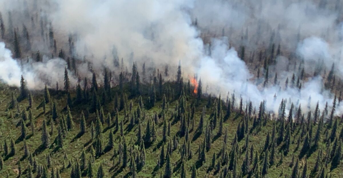
Wildfires are becoming more frequent and destructive worldwide, threatening lives, homes, and vital ecosystems. Millions of acres burn yearly, displacing communities and causing billions in damages. Early detection is critical to stopping fires before they explode into uncontrollable infernos. However, current monitoring methods often lag, leaving responders scrambling to catch up. This delay can mean distinguishing between a manageable blaze and a catastrophic disaster.
In many regions, firefighting resources are stretched thin, and the window for effective intervention is shrinking. As climate change intensifies droughts and heatwaves, the stakes have never been higher. How prepared is your community to face the next wildfire emergency? The need for faster, more accurate detection has never been more urgent.
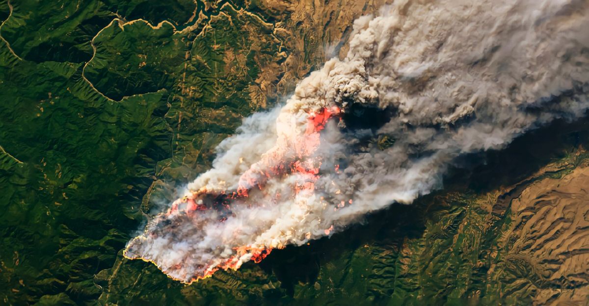
From Spotty Photos to Real-Time Data
Not long ago, wildfire tracking relied heavily on aerial photos and satellite images that were often delayed or low-resolution. Firefighters and emergency teams had to make critical decisions with incomplete or outdated information, sometimes watching helplessly as fires grew unchecked. This patchwork approach made predicting fire behavior difficult and allocating resources efficiently.
The frustration and uncertainty experienced by frontline responders and affected communities were common. Today, the memory of slow, unreliable data is a stark reminder of the challenges faced in wildfire management. But technology is evolving rapidly, promising to replace these old limitations with near-instant, high-precision monitoring that could change the game entirely.
Limitations of Traditional Monitoring
Traditional wildfire monitoring faces significant challenges. Airborne patrols, while helpful, are expensive and cover limited areas. Existing satellites provide valuable data, but often update only every few hours and may miss smaller or early-stage fires due to low resolution. This gap in timely, detailed information leaves communities vulnerable and forces firefighting teams into reactive modes rather than proactive strategies.
Without rapid detection, fires can spread unnoticed, escalating risks to people and property. The current system’s shortcomings highlight the urgent need for a new approach, one that can deliver frequent, high-resolution updates to empower faster, more thoughtful responses.
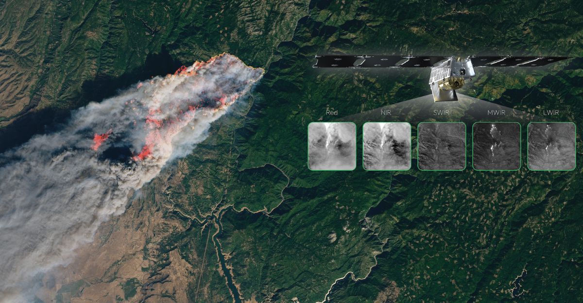
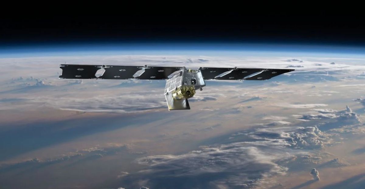
FireSat: Revolutionizing Wildfire Detection
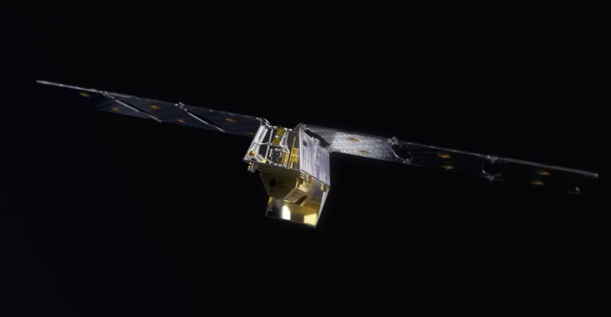
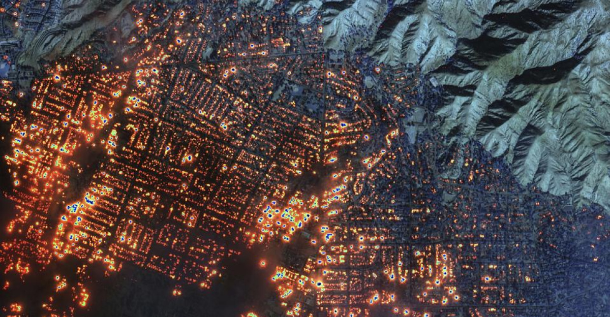
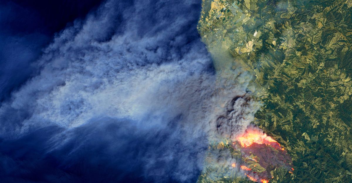
Enter FireSat, a groundbreaking satellite constellation launched in March 2025, scans Earth every 20 minutes using advanced infrared sensors. This network of over 50 satellites can detect fires as small as 5 meters, providing unprecedented accuracy and speed. FireSat’s rapid, high-resolution data enables near real-time wildfire monitoring, allowing responders to act swiftly before fires escalate.
Supported by tech giants like Google and environmental organizations, FireSat represents a significant leap forward in global wildfire surveillance. Its ability to deliver frequent, actionable intelligence promises to save lives, protect ecosystems, and reduce economic losses worldwide. This innovation could begin a new era in disaster preparedness and environmental stewardship.
Regional Benefits and Early Adoption
FireSat’s early adopters include California’s fire agencies, Australian firefighting teams, and regions around the Mediterranean and South America. These areas, prone to severe wildfires, stand to benefit enormously from FireSat’s 20-minute update cycle. Real-time data on fire perimeters and intensity will enhance situational awareness, improve evacuation planning, and optimize resource deployment. Millions of residents in these high-risk zones could see improved safety and faster emergency responses.
Moreover, local fire departments worldwide are expected to gain access to this near-instant wildfire data soon, transforming how communities prepare for and combat fires. FireSat’s regional impact is already reshaping firefighting strategies and fostering greater resilience against wildfire threats.
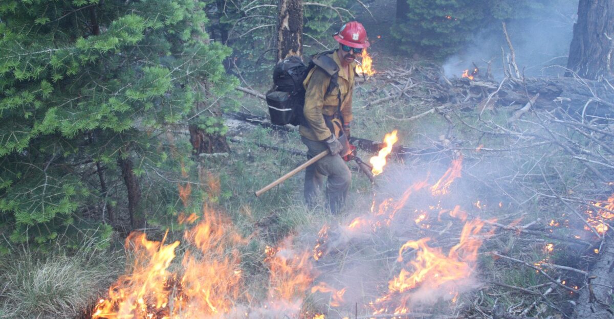
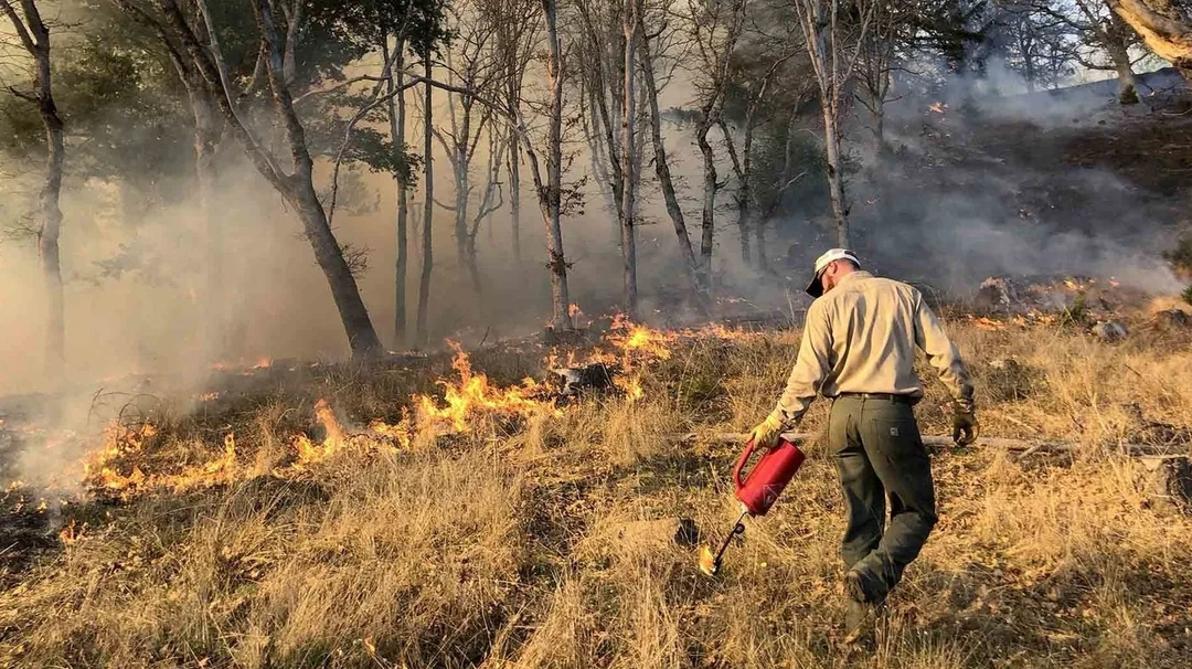
The Human Challenge: Firefighters on the Front Lines
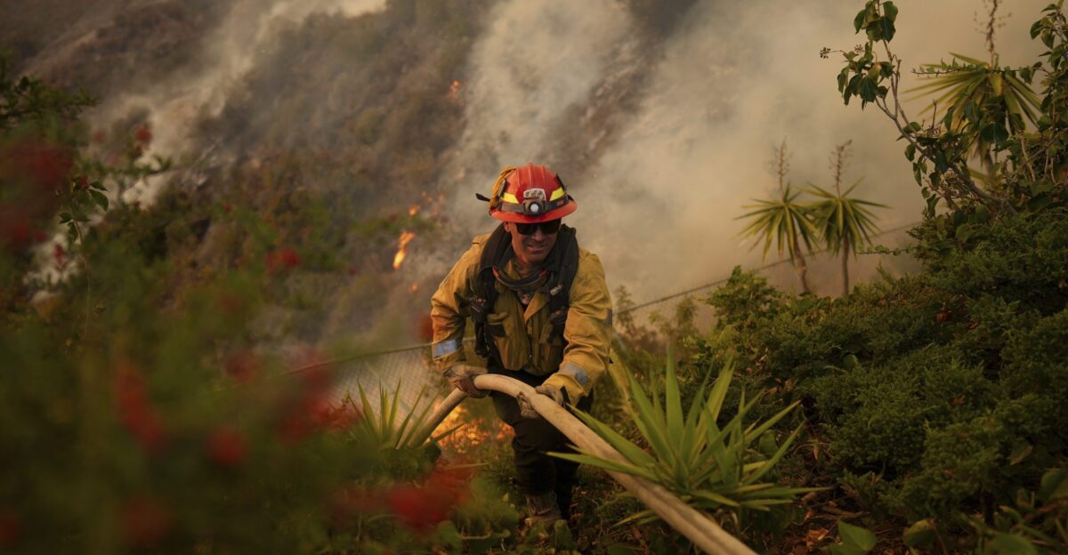
Firefighters face immense pressure battling increasingly frequent and intense wildfires. The physical and emotional toll is enormous, compounded by the stress of making life-or-death decisions with limited information. Delays in wildfire detection can cost lives and property, heightening risks for responders and residents. FireSat’s rapid data delivery offers a vital lifeline, providing timely, accurate information that supports better decision-making and safer firefighting operations.
By reducing uncertainty and improving situational awareness, this technology can help ease the burden on frontline heroes, empowering them to protect communities more effectively. The human element underscores the profound value of innovations like FireSat in the ongoing battle against wildfires.
Disrupting the Wildfire Monitoring Market
FireSat is shaking up the traditional wildfire monitoring industry, which has long relied on airplanes and older satellite systems. Its high-resolution, multi-band infrared technology sets a new standard for speed and precision. Backed by influential partners like Google and the Earth Fire Alliance, FireSat pushes the market toward real-time, actionable intelligence.
This competitive pressure drives innovation and encourages other players to adopt more advanced technologies. As FireSat leads the charge, the wildfire monitoring landscape evolves rapidly, promising more innovative tools and better community outcomes worldwide.
Shifting Consumer and Government Expectations
As climate change fuels more frequent and severe wildfires, demand for more innovative, faster disaster detection tools is growing. Communities and governments increasingly use technology to mitigate risks, protect natural resources, and safeguard public safety. FireSat’s constellation meets this urgent need by providing near-real-time wildfire data that supports proactive responses.
This shift reflects a broader trend toward embracing advanced environmental monitoring and disaster preparedness technologies. The public’s rising expectations for transparency and rapid action drive investment in innovations like FireSat, signaling a new era in how society confronts climate-related threats.
The Future of Wildfire Vigilance
By 2030, FireSat aims to have a fully operational constellation scanning the globe every 20 minutes, revolutionizing wildfire management forever. This unprecedented vigilance could reshape our relationship with nature’s most destructive forces, enabling earlier interventions and reducing wildfire impacts.
Yet, the question remains: Are we ready to harness this powerful technology to save lives and landscapes? The promise is immense, but realizing it will require continued collaboration, investment, and public support. As we look ahead, FireSat symbolizes hope and innovation in the fight against wildfires, a crucial step toward a safer, more resilient future.


